1
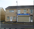
Whitstable Inn, Llanelli
Pub at 77 New Dock Road.
Image: © Jaggery
Taken: 8 Apr 2012
0.05 miles
2
Emmanuel Baptist Church, Llanelli
The New Dock Road church was built in 1893-1894.
Image: © Jaggery
Taken: 8 Apr 2012
0.05 miles
3
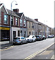
John's Fish & Chip shop, New Dock Road, Llanelli
Fish & chip shop, off licence and grocery store located opposite Florence Street.
Image: © Jaggery
Taken: 8 Apr 2012
0.10 miles
4
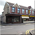
Three shops, New Dock Road, Llanelli
The shops are on the corner of Stanley Street.
The corner shop is Beyond the Fringe, unisex hair salon.
The middle shop is Llanelli Chinese & Cantonese Takeaway.
The third shop is New Dock Newsagents, off licence and general stores.
Image: © Jaggery
Taken: 8 Apr 2012
0.10 miles
5
On-street parking area, New Dock Road, Llanelli
On-street parking is allowed between Jenkins Bakery http://www.geograph.org.uk/photo/4616350 on the left and the corner of Florence Street ahead. Double yellow lines on the right side of the road indicate no parking at any time.
Image: © Jaggery
Taken: 15 Aug 2015
0.10 miles
6
St David's Row, Llanelli
The building on the west side of Stanley Road was formerly St David's Church, built in 1892.
It has been converted to six dwellings, 1-6 St David's Row.
Image: © Jaggery
Taken: 8 Apr 2012
0.10 miles
7
Ordnance Survey Cut Mark
This OS cut mark can be found on No17 New Dock Street. It marks a point 6.9799m above mean sea level.
Image: © Adrian Dust
Taken: 20 Jul 2014
0.12 miles
8
Trinity chapel, New Dock Road, Llanelli
Located on the corner of New Dock Road and Trinity Road.
The chapel is an 1867 rebuild of the original, built in 1858 as a Calvinistic Methodist chapel.
Image: © Jaggery
Taken: 8 Apr 2012
0.13 miles
9
Trinity schoolroom, New Dock Road, Llanelli
Located alongside Trinity chapel. http://www.geograph.org.uk/photo/2892965
Image: © Jaggery
Taken: 8 Apr 2012
0.13 miles
10
Jenkins Bakery, New Dock Road, Llanelli
The unnamed shop next door to Jenkins Bakery is on the corner of Trinity Road.
Image: © Jaggery
Taken: 15 Aug 2015
0.13 miles


