1
Pedestrian crossing
A pedestrian crossing Station Road, Llanelli.
Image: © Alan Hughes
Taken: 26 Jun 2019
0.06 miles
2
First Cymru bus depot and yard, Llanelli
On the corner of Inkerman Street and Ralph Street.
Image: © Jaggery
Taken: 8 Apr 2012
0.06 miles
3
Thomas Stained Glass, Llanelli
Glass supplier in Inkerman Street.
Image: © Jaggery
Taken: 8 Apr 2012
0.07 miles
4
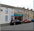
Barnums pub for sale or to let, Llanelli
At the April 2012 date of the view, there was an estate agents' For Sale or To Let
board on the colourful pub on the corner of Station Road and Waterloo Street.
Image: © Jaggery
Taken: 8 Apr 2012
0.07 miles
5
The Vine Inn, Llanelli
Located on the corner of Station Road and Pemberton Street, the Vine Inn looks disused in this view taken in April 2012. Signs on the wall have faded. The empty wall brackets formerly held flower baskets.
Image: © Jaggery
Taken: 8 Apr 2012
0.08 miles
6
Inkerman Street, Llanelli
Looking ENE towards Ebenezer Chapel. http://www.geograph.org.uk/photo/3634600
Image: © Jaggery
Taken: 8 Apr 2012
0.08 miles
7
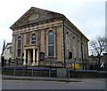
Ebenezer Chapel, Llanelli
On the corner of Ralph Street and Inkerman Street. A faded date stone shows the year 1881.
Image: © Jaggery
Taken: 8 Apr 2012
0.09 miles
8
Church building
One of the several churches in Llanelli that have fallen into disuse over the years and are now being used for different purposes. This church now contains a furniture warehouse. The organ and pulpit are still in place, but where once there were pews there are now settees and sofas - a curious sight indeed.
Image: © Hywel Williams
Taken: 26 Oct 2006
0.09 miles
9
"Greenfield Road" (Recreated)
This is a recreation of the following 1896 picture from the Frith collection: http://www.francisfrith.com/search/wales/dyfed/llanelli/photos/llanelli_38744.htm
The Frith collection describe this as Greenfield Road and indeed the chapel has Greenfield in its name stone, however there is no Greenfield Road here today. The church is on the corner of Murray Street and Station Road, with the photograph being taken in the middle of Queen Victoria Road.
The smaller chapel has been replaced by housing but the other buildings remain largely the same from 1896 to 2007.
Image: © Hywel Williams
Taken: 8 Jan 2007
0.10 miles
10
Greenfield Baptist Chapel, Llanelli
On the corner of Station Road and Murray Street. The large name tablet in the pediment shows the year 1858. Llanelli by the mid 1850s was developing both industrially and as a thriving port. There had been an influx of English-speaking families, mainly from the west of England, looking for work in the town's iron, steel and shipping industries. This church was built to meet their wishes to worship in English in a town where existing chapels held services in Welsh.
Image: © Jaggery
Taken: 8 Apr 2012
0.10 miles


