
IMAGES TAKEN NEAR TO
Ridgewood Park, LLANELLI, SA15 1JS
Introduction
This page details the photographs taken nearby to Ridgewood Park, SA15 1JS by members of the Geograph project.
The Geograph project started in 2005 with the aim of publishing, organising and preserving representative images for every square kilometre of Great Britain, Ireland and the Isle of Man.

There are currently over 7.5m images from over14,400 individuals and you can help contribute to the project by visiting https://www.geograph.org.uk
Image Map
Images are licensed for reuse under creativecommons.org/licenses/by-sa/2.0
Notes
- Clicking on the map will re-center to the selected point.
- The higher the marker number, the further away the image location is from the centre of the postcode.
Image Listing (42 Images Found)
Images are licensed for reuse under creativecommons.org/licenses/by-sa/2.0
Image
Details
Distance
1
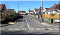
Y Clos, Coed Cae, Llanelli
Viewed across Coed Cae Road. Y Clos leads to the residential street named Ridgewood Park.
Image: © Jaggery
Taken: 10 Mar 2016
0.04 miles
2
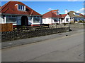
Dormer bungalows, Coed Cae Road, Llanelli
The dormer is the window projecting from the roof.
Image: © Jaggery
Taken: 10 Mar 2016
0.09 miles
3
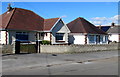
Coed Cae Road bungalows, Llanelli
Opposite Nightingale Court.
Image: © Jaggery
Taken: 10 Mar 2016
0.09 miles
4
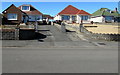
Coed Cae Road bungalows, Llanelli
Located near the Glyncoed Terrace junction.
Image: © Jaggery
Taken: 10 Mar 2016
0.09 miles
5
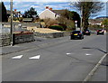
Coed Cae Road speed bumps, Llanelli
From this walker's viewpoint, the bumps look inconsequential, in contrast to,
for example, the speed bumps http://www.geograph.org.uk/photo/4764203 across Stonehouse High Street.
Image: © Jaggery
Taken: 10 Mar 2016
0.10 miles
6
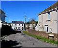
Zammit Crescent, Llanelli
Cul-de-sac on the north side of Coed Cae Road.
Image: © Jaggery
Taken: 10 Mar 2016
0.10 miles
7
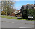
Bilingual name sign - Nightingale Court/Cwrt-yr-Eos, Llanelli
Viewed from the corner of Coed Cae Road.
Most of the street name signs I saw in Llanelli today are in both English and Welsh, as here.
Image: © Jaggery
Taken: 10 Mar 2016
0.11 miles
8
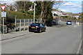
Ildiwch 50 llath/Give Way 50 yards, Coed Cae Road, Llanelli
The bilingual (Welsh/English) warning sign is on the approach to the Glyncoed Terrace junction.
Image: © Jaggery
Taken: 10 Mar 2016
0.11 miles
9
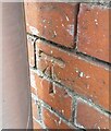
Ordnance Survey Cut Mark
This OS cut mark can be found on the wall at Woodland, Capel Road. It marks a point 24.311m above mean sea level.
Image: © Adrian Dust
Taken: 10 May 2021
0.12 miles
10
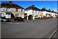
Coed Cae Road semis, Llanelli
Semi-detached houses northeast of Zammit Crescent. http://www.geograph.org.uk/photo/4858318
Image: © Jaggery
Taken: 10 Mar 2016
0.12 miles