1
Victorian terrace houses, Llanelli
College Hill.
Image: © Gary Davies
Taken: 27 Jul 2004
0.05 miles
2
Capel Als, Marble Hall Road, Llanelli.
Capel Als, Marble Hall Road. Off to the left in the photograph is Wern Street, whilst Als Street runs to the right of the building.
Image: © Gary Davies
Taken: 27 Jul 2004
0.06 miles
3
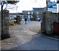
Turn right here for Elim Pentecostal Church and Myrtle House, Llanelli
The direction sign on the corner of Tunnel Road points towards Myrtle Terrace. http://www.geograph.org.uk/photo/4890401
Image: © Jaggery
Taken: 10 Mar 2016
0.07 miles
4
No parking on Tunnel Road, Llanelli
Double yellow lines on both sides indicate no parking at any time.
Image: © Jaggery
Taken: 10 Mar 2016
0.07 miles
5
Ordnance Survey Pivot
This heavily painted OS pivot can be found on No29 Marblehall Road. It marks a point 17.877m above mean sea level.
Image: © Adrian Dust
Taken: 20 Jul 2014
0.07 miles
6
St Joseph's Court, Llanelli
Modern flats accessed from Cedric Street.
Image: © Jaggery
Taken: 10 Mar 2016
0.08 miles
7
Entrance to Elim Pentecostal Church and Myrtle House, Llanelli
From the top of Myrtle Terrace, http://www.geograph.org.uk/photo/4890401 accessed from Tunnel Road.
Image: © Jaggery
Taken: 10 Mar 2016
0.09 miles
8
Myrtle Terrace, Llanelli
Ascending from Tunnel Road to the entrance http://www.geograph.org.uk/photo/4890394 to Elim Pentecostal Church and Myrtle House.
Image: © Jaggery
Taken: 10 Mar 2016
0.09 miles
9
This way to Elim Pentecostal Church and Myrtle House, Llanelli
The black arrow on the sign on the corner of Wern Road points right along Tunnel Road.
Image: © Jaggery
Taken: 10 Mar 2016
0.09 miles
10
We're big on fresh, Wern Road, Llanelli
The Londis lorry has brought new stock for the nearby Londis convenience store http://www.geograph.org.uk/photo/4866561
Image: © Jaggery
Taken: 10 Mar 2016
0.10 miles


