1
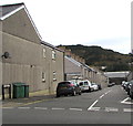
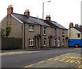
Earl Street, Swansea
From the B4603 Neath Road, Earl Street leads to Grandison Street.
Image: © Jaggery
Taken: 25 Oct 2018
0.01 miles
2
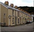
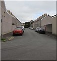
Row of houses, Earl Street, Swansea
East of the Grandison Street junction.
Image: © Jaggery
Taken: 25 Oct 2018
0.02 miles
3
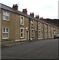
Jersey Street houses, Hafod, Swansea
Houses on the north side of Jersey Street in the Hafod area of Swansea.
Dead-end Jersey Street connects with the B4603 Neath Road behind the camera.
Image: © Jaggery
Taken: 25 Oct 2018
0.03 miles
4
Ordnance Survey Cut Mark
This OS cut mark can be found on the wall at the end of Earl Street. It marks a point 16.548m above mean sea level.
Image: © Adrian Dust
Taken: 5 Jan 2021
0.03 miles
5
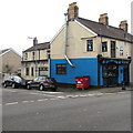
Oh My Cod in Swansea
Fish & chips shop at 1392 Neath Road on the corner of Earl Street.
The building was formerly the Jersey Arms pub.
Image: © Jaggery
Taken: 25 Oct 2018
0.05 miles
6
Earl Street house, Swansea
West of the Grandison Street junction.
Image: © Jaggery
Taken: 25 Oct 2018
0.05 miles
7
High-numbered row of houses, Neath Road, Swansea
The four houses are 1388-1391 Neath Road.
The blue and white Oh My Cod fish & chips shop https://www.geograph.org.uk/photo/5953786 is in the background.
Image: © Jaggery
Taken: 25 Oct 2018
0.05 miles
8
Hafod Packed Meals Chinese name sign, Swansea
Hanging from a wall bracket https://www.geograph.org.uk/photo/5954789 at 1394 Neath Road in the Hafod area of Swansea.
Image: © Jaggery
Taken: 25 Oct 2018
0.05 miles
9
Hafod Packed Meals, Swansea
Chinese takeaway at 1394 Neath Road in the Hafod area of Swansea.
Image: © Jaggery
Taken: 25 Oct 2018
0.05 miles
10
Grandison Street, Swansea
From Earl Street along Grandison Street towards Maliphant Street.
Image: © Jaggery
Taken: 25 Oct 2018
0.05 miles


