IMAGES TAKEN NEAR TO
Morfa Road, SWANSEA, SA1 2FD
Introduction
This page details the photographs taken nearby to Morfa Road, SA1 2FD by members of the Geograph project.
The Geograph project started in 2005 with the aim of publishing, organising and preserving representative images for every square kilometre of Great Britain, Ireland and the Isle of Man.

There are currently over 7.5m images from over14,400 individuals and you can help contribute to the project by visiting https://www.geograph.org.uk
Image Map (Loading...)


Getting Data...Please wait
Leaflet Map data © OpenStreetMap
Images are licensed for reuse under creativecommons.org/licenses/by-sa/2.0
Notes
- Clicking on the map will re-center to the selected point.
- The higher the marker number, the further away the image location is from the centre of the postcode.
Image Listing (82 Images Found)
Images are licensed for reuse under creativecommons.org/licenses/by-sa/2.0
Image
Details
Distance
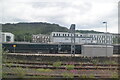
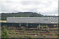
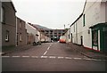
4
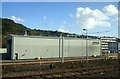
Hitachi train maintenance building, Swansea
Image: © JThomas
Taken: 16 Oct 2019
0.07 miles
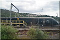
5
Railway warehouse in Hafod
This was demolished in 1994 I think. I remember watching it being demolished in my grandparents house in Earl Street. It was near the railway line visible from Jersey Street.
Image: © J WILLIAMS
Taken: Unknown
0.08 miles
6
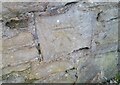
Ordnance Survey Cut Mark
This OS cut mark can be found on the wall at the end of Earl Street. It marks a point 16.548m above mean sea level.
Image: © Adrian Dust
Taken: 5 Jan 2021
0.11 miles
7
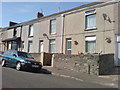
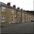
Nos 17 to 20 Villiers Street
Thomas John Fox of number 20 married Elizabeth Davies of number 18 at St John's Church in 1903.
Image: © Deborah Tilley
Taken: 26 Jul 2008
0.13 miles
8
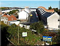
Hafod Street, Swansea
Viewed across the A483 from Bethesda Street. There is a roofless building on the left.
Image: © Jaggery
Taken: 10 Nov 2013
0.13 miles
9
Jersey Street houses, Hafod, Swansea
Houses on the north side of Jersey Street in the Hafod area of Swansea.
Dead-end Jersey Street connects with the B4603 Neath Road behind the camera.
Image: © Jaggery
Taken: 25 Oct 2018
0.13 miles
10
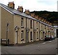
Row of houses, Earl Street, Swansea
East of the Grandison Street junction.
Image: © Jaggery
Taken: 25 Oct 2018
0.14 miles