1
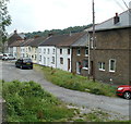
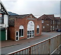
Godfrey Avenue, Glynneath
Image: © David Gentle
Taken: 26 May 2007
0.04 miles
2
Pentre Street, Glynneath
Looking down Pentre Street towards the River Neath at the end of the road and the A465 on the other side of the river
Image: © David Gentle
Taken: 26 May 2007
0.05 miles
3
Godfrey Avenue, Glynneath
The view north from the end of the street, on the north bank of the River Neath.
Image: © Jaggery
Taken: 7 Aug 2011
0.06 miles
4
Eastern side of Pentre Street, Glynneath
Viewed from the southern end of the street, on the north bank of the River Neath.
Image: © Jaggery
Taken: 7 Aug 2011
0.06 miles
5
West side of Pentre Street, Glynneath
Viewed from the southern end of the street, on the north bank of the River Neath.
Beyond the semi-detached houses, a long row of about 30 houses http://www.geograph.org.uk/photo/2577059 extends to the junction with Chain Walk.
Image: © Jaggery
Taken: 7 Aug 2011
0.06 miles
6
Kumar Stores, Glynneath
Newsagents, grocery store and off-licence on the corner of Chain Walk and Pentre Street.
Image: © Jaggery
Taken: 31 Jul 2011
0.07 miles
7
Long row of houses, Pentre Street, Glynneath
Behind the camera are semi-detached houses http://www.geograph.org.uk/photo/2577000 on the west side of Pentre Street.
Ahead, a row of about 30 houses extends for 150 metres, to the edge of Chain Walk.
Image: © Jaggery
Taken: 7 Aug 2011
0.07 miles
8
Mill Terrace, Glynneath
Mill Terrace is a row of 14 houses beyond the eastern end of Chain Walk.
Image: © Jaggery
Taken: 31 Jul 2011
0.09 miles
9
Lamb & Flag, Glynneath
Lamb & Flag area of Glynneath looking towards Pentre Street.
Image: © David Gentle
Taken: 20 Oct 2005
0.09 miles
10
WBA Carpets & Blinds, Glynneath
Located on the corner of Chain Walk and Godfrey Avenue. Formerly a garage - the subtle clue GARAGE is embossed in stone below the clock. On the left is the edge of Glynneath Convenience Stores. http://www.geograph.org.uk/photo/2577083
Image: © Jaggery
Taken: 31 Jul 2011
0.10 miles


