1
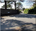
Cemetery at Llantwit, Neath
Cemetery opposite St Illtyd's Church, Neath.
Image: © Alan Hughes
Taken: 10 Oct 2018
0.06 miles
2
Harold Davies sculptors, Neath
Harold Davis Sculptures Ltd is at 117 Llantwit Road, Neath.
Image: © Jaggery
Taken: 5 May 2016
0.08 miles
3
Ordnance Survey Cut Mark
This damaged OS cut mark can be found on the cemetery wall to the SE of Llantwit Road. It marks a point 19.099m above mean sea level.
Image: © Adrian Dust
Taken: 18 May 2014
0.09 miles
4
Ordnance Survey Cut Mark
This OS cut mark can be found on the cemetery wall junction post to the SE of Llantwit Road. It marks a point 8.986m above mean sea level.
Image: © Adrian Dust
Taken: 18 May 2014
0.09 miles
5
Junction of Neath Road and Fairyland Road, Llantwit, Neath
From the left, Fairyland Road joins the B4434 Neath Road. The Llantwit boundary sign https://www.geograph.org.uk/photo/6033202 is nearby.
Image: © Jaggery
Taken: 5 May 2016
0.09 miles
6
Junction of Fairyland Road and Neath Road, Tonna
Fairyland Road on the camera side joins the B4434 Neath Road.
Image: © Jaggery
Taken: 5 May 2016
0.09 miles
7
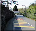
Towards a bend in the B4434 Llantwit Road, Llantwit, Neath
English/Welsh SLOW/ARAF are painted on the road surface.
A perimeter wall of Llantwit Cemetery is on the left.
Llantwit Cottage https://www.geograph.org.uk/photo/6030423 is in the background.
Image: © Jaggery
Taken: 5 May 2016
0.09 miles
8
Bend in Llantwit Road, Llantwit, Neath
The B4434 towards Tonna. Llantwit Cottage https://www.geograph.org.uk/photo/6030423 is on the left.
Image: © Jaggery
Taken: 5 May 2016
0.10 miles
9
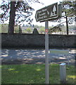
Moss House Cascades & Picnic Site direction & distance sign, Llantwit, Neath
Located on the grass triangle here https://www.geograph.org.uk/photo/6033227 three-quarters of a mile from Moss House Cascades & Picnic Site.
Image: © Jaggery
Taken: 5 May 2016
0.10 miles
10
Welcome to Tonna
The village welcome sign faces the Neath suburb of Llantwit near the corner of Fairyland Road.
CROESO I is Welsh for Welcome To. A few daffodils remain in bloom on May 5th 2016.
Image: © Jaggery
Taken: 5 May 2016
0.10 miles


