1
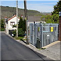
Wenallt Road electricity substation, Tonna
The Western Power Distribution electricity substation identifier is S/S 56-2516.
Image: © Jaggery
Taken: 5 May 2016
0.01 miles
2
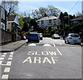
Speed hump across Wenallt Road, Tonna
Near the corner of St Anne's Drive, on the ascent from the B4434 in the valley of the River Neath.
Image: © Jaggery
Taken: 5 May 2016
0.02 miles
3
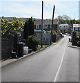
Minor crossroads in Tonna
The cars are on Wenallt Road which ascends past St Anne's Drive on the left and Dolcoed Terrace (leading to Dolcoed Place) on the right.
Image: © Jaggery
Taken: 5 May 2016
0.02 miles
4
Warning sign - hump 50 yds, Wenallt Road, Tonna
Wenallt Road ascends from the B4434 in the valley of the River Neath, towards this http://www.geograph.org.uk/photo/5048854 speed hump.
Image: © Jaggery
Taken: 5 May 2016
0.02 miles
5
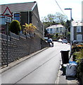
Up Wenallt Road, Tonna
Wenallt Road ascends to the SE, away from the B4434.
Image: © Jaggery
Taken: 5 May 2016
0.02 miles
6
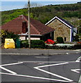
Yellow and dark green on a Tonna corner
On the corner of Dolcoed Terrace and Wenallt Road are a yellow box for road grit
or salt and a dark green cabinet on which a label shows DANGER Explosive atmosphere.
Image: © Jaggery
Taken: 5 May 2016
0.02 miles
7
Dolcoed Terrace, Tonna
Row of five houses between Wenallt Road (on the left) and Dolcoed Place.
Image: © Jaggery
Taken: 5 May 2016
0.03 miles
8
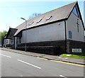
Noddfa Newydd Baptist Church, Tonna
Viewed from the edge of Wenallt Road. The church is being used as a polling station today, Thursday May 5th 2016, for elections to the National Assembly for Wales and for the local Police and Crime Commissioner.
Image: © Jaggery
Taken: 5 May 2016
0.03 miles
9
East side of Noddfa Newydd Baptist Church, Tonna
Viewed across Wenallt Road. http://www.geograph.org.uk/photo/4950757 to the south side of the church.
The church is in use as polling station http://www.geograph.org.uk/photo/4950760 today, Thursday May 5th 2016.
Image: © Jaggery
Taken: 5 May 2016
0.03 miles
10
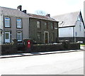
Postbox in a Tonna wall
In the wall on the south side of the B4434 St Anne's Terrace.
Noddfa Newydd Baptist Church http://www.geograph.org.uk/photo/4950757 is in the background.
Image: © Jaggery
Taken: 5 May 2016
0.04 miles


