1
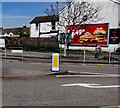
Gnoll Mini Market, Neath
Lifestyle Express convenience store at 48 Gnoll Park Road.
Image: © Jaggery
Taken: 5 May 2016
0.02 miles
2
Row of stone houses, Gnoll Park Road, Neath
Extending for 30 metres from Rosser Street to Gnoll Mini Market http://www.geograph.org.uk/photo/4939414 on the left.
Image: © Jaggery
Taken: 5 May 2016
0.02 miles
3
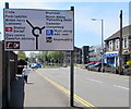
Directions sign, Gnoll Park Road, Neath
On the approach to the roundabout at the Prince of Wales Drive junction.
Image: © Jaggery
Taken: 5 May 2016
0.02 miles
4
Southern boundary sign, Llantwit, Neath
The small sign is on the corner of Prince of Wales Drive and Gnoll Park Road. In the 5th century, St Illtud visited this area and established a settlement in what is now Llantwit in the north of Neath.
Image: © Jaggery
Taken: 5 May 2016
0.02 miles
5
Bilingual name sign - Gnoll Park Road/Heol Parc y Gnoll, Neath
Opposite the Prince of Wales Drive junction.
The Neath and Port Talbot Coat of Arms is on the left. The Welsh motto is
LLWYDDO DRWY YMDRECH, which means SUCCEEDING THROUGH ENDEAVOUR.
Image: © Jaggery
Taken: 5 May 2016
0.03 miles
6
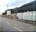
Gnoll Park Road, Neath
The view NE along the B4434 from opposite Eric's shop. Neath RFC's stadium is on the right http://www.geograph.org.uk/photo/2277118
Image: © Jaggery
Taken: 19 Feb 2011
0.03 miles
7
Entrance to Town End Terrace, The Gnoll, Neath
Viewed across Gnoll Park Road. The Gnoll is the home ground of Neath Rugby Football Club. A cricket pitch adjoins the SE side of the rugby pitch.
Image: © Jaggery
Taken: 19 Feb 2011
0.03 miles
8
Rugby ground side of Gnoll Park Road, Neath
The NW edge of The Gnoll, home ground of Neath Rugby Football Club, extends for about 140 metres along the NE edge of Gnoll Park Road. There are several entrances on this side. The one ahead, Entrance B, is to the grandstand.
Image: © Jaggery
Taken: 19 Feb 2011
0.03 miles
9
Gnoll Nursing Home, Neath
Located at 27 Gnoll Park Road, near the Gnoll rugby ground.
Image: © Jaggery
Taken: 3 May 2016
0.03 miles
10
Change of house type, Gnoll Park Road, Neath
The houses are between Hibbert Road (out of shot on the right) and Rosser Street.
Image: © Jaggery
Taken: 5 May 2016
0.04 miles


