1
Ordnance Survey Cut Mark
This OS cut mark can be found on the wall north side of Hillside. It marks a point 33.687m above mean sea level.
Image: © Adrian Dust
Taken: 29 Aug 2019
0.08 miles
2
Quest in Neath
A "One Stop Shop" convenience store on the corner of Lewis Road and Llewellyn Street.
Image: © Jaggery
Taken: 16 Feb 2014
0.11 miles
3
Ordnance Survey Cut Mark
This OS cut mark can be found on the wall of Fernbank, Hillside. It marks a point 30.643m above mean sea level.
Image: © Adrian Dust
Taken: 29 Aug 2019
0.11 miles
4
Scaffolding on a long row of houses, Neath
Viewed from the corner of Eastland Place in late April 2016.
Scaffolding is on the Eastland Road side of houses in Maes-y-ffynnon Close.
Image: © Jaggery
Taken: 29 Apr 2016
0.11 miles
5
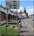
Directions sign facing the B4434 Eastland Road, Neath
Alongside Poppy Court houses. Neath Methodist Church http://www.geograph.org.uk/photo/4959792 is in the background.
Image: © Jaggery
Taken: 29 Apr 2016
0.11 miles
6
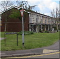
Eastland Place flats, Neath
Viewed from the corner of Eastland Road.
Image: © Jaggery
Taken: 29 Apr 2016
0.12 miles
7
Ordnance Survey Cut Mark
This OS cut mark can be found on No7 Lewis Road. It marks a point 13.430m above mean sea level.
Image: © Adrian Dust
Taken: 15 Dec 2013
0.12 miles
8
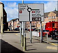
Directions sign facing the SW end of the B4434 Eastland Road, Neath
There is a break of c130 metres in the course of the B4434 at the roundabout ahead, where the road is the A474. The B4434 continues as Windsor Road (towards Neath railway station) beyond the far side of the roundabout.
Image: © Jaggery
Taken: 29 Apr 2016
0.13 miles
9
Eastland Place, Neath
Flats on the SE side of Eastland Road.
Image: © Jaggery
Taken: 16 Feb 2014
0.13 miles
10
Eastland Road houses, Neath
The brown sign lists several nearby places of interest -
Afan Forest Park, Miners Museum, Neath Leisure Centre, Gnoll Estate and Gwyn Hall.
Image: © Jaggery
Taken: 16 Feb 2014
0.13 miles


