IMAGES TAKEN NEAR TO
Cromwell Road, NEATH, SA10 8DR

Introduction

This page details the photographs taken nearby to Cromwell Road, SA10 8DR by members of the Geograph project.

The Geograph project started in 2005 with the aim of publishing, organising and preserving representative images for every square kilometre of Great Britain, Ireland and the Isle of Man.

There are currently over 7.5m images from over14,400 individuals and you can help contribute to the project by visiting https://www.geograph.org.uk

Image Map


Images are licensed for reuse under creativecommons.org/licenses/by-sa/2.0
Notes
  • Clicking on the map will re-center to the selected point.
  • The higher the marker number, the further away the image location is from the centre of the postcode.

Image Listing (54 Images Found)

Images are licensed for reuse under creativecommons.org/licenses/by-sa/2.0
  • ...
Image
Details
Distance
1
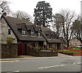
Blaenwern, Neath
Houses set back from the east side of Penywern Road.
Image: © Jaggery Taken: 14 Mar 2014
0.08 miles
2
Penywern Road bungalows, Neath
Set above the east side of the road.
Image: © Jaggery Taken: 14 Mar 2014
0.09 miles
3
3-gable houses, Penywern Road, Neath
Located opposite the Llygad-yr-Haul junction.
Image: © Jaggery Taken: 14 Mar 2014
0.09 miles
4
Ordnance Survey Cut Mark
This OS cut mark can be found on the blocked entrance gatepost east side of the road. It marks a point 34.375m above mean sea level.
Image: © Adrian Dust Taken: 24 Apr 2020
0.10 miles
5
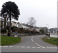
Daphne Road, Neath
Looking across Penywern Road past a monkey puzzle tree (Araucaria araucana).
Image: © Jaggery Taken: 14 Mar 2014
0.10 miles
6
Leiros Parc Drive near Neath
Looking across the A474 Penywern Road along Leiros Parc Drive which leads to several cul-de-sacs.
Image: © Jaggery Taken: 14 Mar 2014
0.10 miles
7
Woodlands Park Road, Cadoxton-juxta-Neath
Three-storey housing at the edge of woodland.
Image: © Jaggery Taken: 3 May 2016
0.12 miles
8
Llwybr Leiros Parc Drive Path
Llwybr cyhoeddus mewn ystad dai. A public footpath in a housing estate.
Image: © Alan Richards Taken: 5 Aug 2016
0.13 miles
9
SW arm of Daphne Road, Neath
This arm of Daphne Road joins Penywern Road 120 metres south of the NW arm. Lurking behind a hedge on the left is this http://www.geograph.org.uk/photo/3987047 newly-repainted postbox.
Image: © Jaggery Taken: 14 Mar 2014
0.14 miles
10
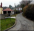
Mill Road, Neath
Viewed from Llygad-yr-Haul near the Penywern Road junction.
Image: © Jaggery Taken: 14 Mar 2014
0.14 miles
  • ...