1
Ordnance Survey Cut Mark
This OS cut mark can be found on the wall of No6 Cwm Bach Road. It marks a point 37.055m above mean sea level.
Image: © Adrian Dust
Taken: 24 Apr 2020
0.01 miles
2
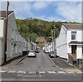
Beaconsfield Street, Cadoxton
Viewed across Church Road.
Image: © Jaggery
Taken: 3 May 2016
0.02 miles
3
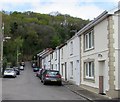
Cars and houses, Glebeland Street, Cadoxton
Glebeland Street is between Church Road and Cwmbach Road (ahead).
Image: © Jaggery
Taken: 3 May 2016
0.04 miles
4
Church Road houses, Cadoxton
Houses on the north side of Church Road (A4230) between Beaconsfield Road and Bryn Catwg, viewed from the corner of Stanley Place.
Image: © Jaggery
Taken: 19 Feb 2011
0.06 miles
5
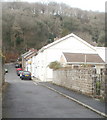
Glebeland Street, Cadoxton
From the corner of Church Road. The name sign shows that Glebeland Street is Heol Tir Eglwys in Welsh.
Image: © Jaggery
Taken: 3 May 2016
0.07 miles
6
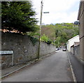
Glebeland Street, Cadoxton
Viewed from the Church Road end.
There are houses only on the east side of the street. The houses face the long perimeter wall of The Old Vicarage. The far end of the street connects with Cwmbach Road.
Image: © Jaggery
Taken: 19 Feb 2011
0.07 miles
7
Row of four houses, Church Road, Cadoxton
On the north side of the A4230 Church Road.
Image: © Jaggery
Taken: 3 May 2016
0.09 miles
8
Family Fare shop, Cadoxton
Shop at 16 Church Road on the corner of Beaconsfield Street.
Image: © Jaggery
Taken: 3 May 2016
0.09 miles
9
Edwardian foundation stone, Church Road, Cadoxton
Dated January 25th 1906, the stone is part of this https://www.geograph.org.uk/photo/5636655 building.
Image: © Jaggery
Taken: 3 May 2016
0.10 miles
10
Edwardian building, Church Road, Cadoxton
The single-storey building's foundation stone https://www.geograph.org.uk/photo/5636659 shows the year 1906.
Image: © Jaggery
Taken: 3 May 2016
0.10 miles


