IMAGES TAKEN NEAR TO
Claylands Avenue, WORKSOP, S81 7DJ
Introduction
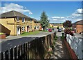
This page details the photographs taken nearby to Claylands Avenue, S81 7DJ by members of the Geograph project.
The Geograph project started in 2005 with the aim of publishing, organising and preserving representative images for every square kilometre of Great Britain, Ireland and the Isle of Man.

There are currently over 7.5m images from over14,400 individuals and you can help contribute to the project by visiting https://www.geograph.org.uk
Image Map
Images are licensed for reuse under creativecommons.org/licenses/by-sa/2.0
Notes
- Clicking on the map will re-center to the selected point.
- The higher the marker number, the further away the image location is from the centre of the postcode.
Image Listing (7 Images Found)
Images are licensed for reuse under creativecommons.org/licenses/by-sa/2.0
Image
Details
Distance
3
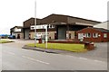
Bus stop on the Claylands Avenue
On the Dukeries Industrial Estate
Image: © Graham Hogg
Taken: 18 May 2015
0.16 miles
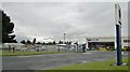
6
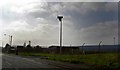
Wind turbine on Claylands Avenue Worksop
Image: © Steve Fareham
Taken: 29 May 2008
0.24 miles