1
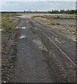
Industrial area south of Creswell
View to a large industrial building from the line of a former railway.
Image: © Andrew Hill
Taken: 22 Oct 2011
0.04 miles
2
Remains of Creswell Colliery
The building is a remnant of the downcast shaft of the Colliery. Its survival is due to the fact that it still houses an emergency winder for the Welbeck Colliery workings.
Image: © Alan Murray-Rust
Taken: 30 Sep 2008
0.08 miles
3
Miners Welfare
Perhaps one of the better examples of a former Miners Welfare building. The stone plaque above the door on the right acclaims "Publ(i)c Hal(l) Entranc(e)" The final 'l' in Hall and the final 'e' in Entrance are both smaller letters inside the previous letter. The 'i' in Public is also shortened to reduce the spacing. Difficult to tell if this was planned or an oversight when marking out for carving.
Image: © Michael Patterson
Taken: 5 Feb 2006
0.10 miles
4
Tub tracks
Some of the few surface remains at the Creswell Colliery site.
Image: © Alan Murray-Rust
Taken: 30 Sep 2008
0.10 miles
5
The loading bunker at Creswell mine.
Like most of the local mines this one has shut and the loading bunker has gone along with all the employment at the mine. A locomotive runs past en -route to Worksop.
Image: © roger geach
Taken: 7 Apr 1988
0.13 miles
6
Creswell Model Village
View from the south east. The large building at the left is the miners' welfare building or Club House.
Image: © Alan Murray-Rust
Taken: 30 Sep 2008
0.14 miles
7
Service road, Model Village, Creswell
This road forms a circuit around the Model Village; the houses back onto it, and front onto either a footpath around the outside or the large green in the centre.
Image: © Richard Vince
Taken: 5 May 2018
0.15 miles
8
Industrial buildings by the railway at Creswell
Just one line of the railway is in view on the right.
Image: © Andrew Hill
Taken: 22 Oct 2011
0.16 miles
9
Road through the centre, Model Village, Creswell
Linking the two long sides of the service road, thereby dividing the green in two. This road continues to Elmton Road and the outside world.
Image: © Richard Vince
Taken: 5 May 2018
0.16 miles
10
The street around Creswell Model Village
As at new Bolsover, the houses were built with their backs to the street. There was a tramway that delivered coal to the houses and took away 'night soil' from the ash privies.
Image: © Humphrey Bolton
Taken: 26 Oct 2015
0.18 miles


