IMAGES TAKEN NEAR TO
Darfoulds, WORKSOP, S80 3DT
Introduction
This page details the photographs taken nearby to S80 3DT by members of the Geograph project.
The Geograph project started in 2005 with the aim of publishing, organising and preserving representative images for every square kilometre of Great Britain, Ireland and the Isle of Man.

There are currently over 7.5m images from over14,400 individuals and you can help contribute to the project by visiting https://www.geograph.org.uk
Image Map
Images are licensed for reuse under creativecommons.org/licenses/by-sa/2.0
Notes
- Clicking on the map will re-center to the selected point.
- The higher the marker number, the further away the image location is from the centre of the postcode.
Image Listing (11 Images Found)
Images are licensed for reuse under creativecommons.org/licenses/by-sa/2.0
Image
Details
Distance
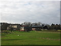
4
Footpath From Darfoulds
This footpath leads from Darfoulds past the greenhouses of a garden nursery and over the fields to Shireoaks and Rhodesia.
Image: © Michael Patterson
Taken: 17 Feb 2006
0.11 miles
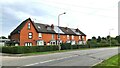
6
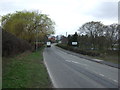
Approaching Hilltop Cottages at Darfoulds
Image: © Neil Theasby
Taken: 6 Aug 2014
0.14 miles
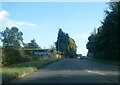
7
Height indicator at Darfoulds
From A619 east
Image: © John Firth
Taken: 12 Jun 2012
0.16 miles
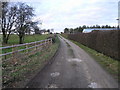
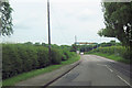
10
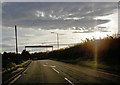
Height indicator on the A619 at Darfoulds
Image: © Steve Fareham
Taken: 10 Oct 2008
0.21 miles