IMAGES TAKEN NEAR TO
Sparken Hill, WORKSOP, S80 3BH
Introduction
This page details the photographs taken nearby to Sparken Hill, S80 3BH by members of the Geograph project.
The Geograph project started in 2005 with the aim of publishing, organising and preserving representative images for every square kilometre of Great Britain, Ireland and the Isle of Man.

There are currently over 7.5m images from over14,400 individuals and you can help contribute to the project by visiting https://www.geograph.org.uk
Image Map
Images are licensed for reuse under creativecommons.org/licenses/by-sa/2.0
Notes
- Clicking on the map will re-center to the selected point.
- The higher the marker number, the further away the image location is from the centre of the postcode.
Image Listing (14 Images Found)
Images are licensed for reuse under creativecommons.org/licenses/by-sa/2.0
Image
Details
Distance
2
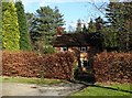
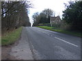
Lodge on Ollerton Road
A lodge on Ollerton Road where Robin Hood Way crosses over the road.
Image: © James Hill
Taken: 22 Sep 2007
0.05 miles
3
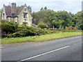
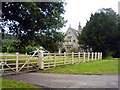
Estate house east of Ollerton Road
Just north of Thrall Hill Plantation - part of the extensive Welbeck Estate.
Image: © Neil Theasby
Taken: 9 Feb 2016
0.07 miles
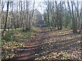
6
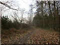
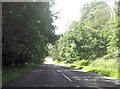
Robin Hood Way
Clumber Road End Wood on the left, Trueman's Brake on the right.
Image: © Jonathan Thacker
Taken: 3 Feb 2023
0.08 miles
8
Another lodge, Ollerton Road
Another well kept lodge on Ollerton Road.
Image: © James Hill
Taken: 22 Sep 2007
0.09 miles
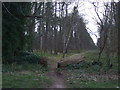
9
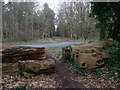
Robin Hood Way
At this point The Robin Hood Way crosses the B6034. The large tree trunks at the end of the path are to prevent off road vehicles using the bridleway.
Image: © Michael Patterson
Taken: 18 Feb 2006
0.11 miles
10
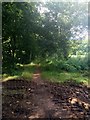
The Robin Hood Way
Heading west from Ollerton Road.
Route of the Robin Hood Way is from Nottingham Castle to the Major Oak near Edwinstowe.
Image: © JThomas
Taken: 16 Mar 2014
0.12 miles