IMAGES TAKEN NEAR TO
Hill End Close, BARNSLEY, S75 6PQ
Introduction
This page details the photographs taken nearby to Hill End Close, S75 6PQ by members of the Geograph project.
The Geograph project started in 2005 with the aim of publishing, organising and preserving representative images for every square kilometre of Great Britain, Ireland and the Isle of Man.

There are currently over 7.5m images from over14,400 individuals and you can help contribute to the project by visiting https://www.geograph.org.uk
Image Map
Images are licensed for reuse under creativecommons.org/licenses/by-sa/2.0
Notes
- Clicking on the map will re-center to the selected point.
- The higher the marker number, the further away the image location is from the centre of the postcode.
Image Listing (13 Images Found)
Images are licensed for reuse under creativecommons.org/licenses/by-sa/2.0
Image
Details
Distance
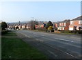
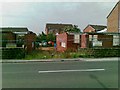
1
Cokesley End on Carr Green Lane
One of a small number of new properties built on reclaimed land
Image: © Graham Hogg
Taken: 11 Jan 2012
0.13 miles
2
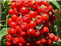
Rowan Berries
Also called Mountain Ash.
Image: © John Fielding
Taken: 11 Aug 2009
0.18 miles
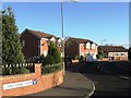
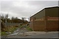
4
Houses under construction, Blacker Road
Image: © Alex McGregor
Taken: 26 Jun 2012
0.19 miles
6

Orange Birch Bolete (Leccinum versipelle)
Found on the old site of North Gawber Colliery, now scrubland with birch trees.
Image: © John Fielding
Taken: 29 Oct 2009
0.19 miles
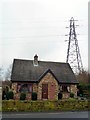
7
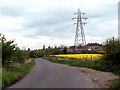
Swallow Hill
Looking to Hill End road
Image: © John Fielding
Taken: 23 Apr 2007
0.19 miles

9

Peacock Butterfly on Buddleia
Buddleia also know as the butterfly bush.
Image: © John Fielding
Taken: 11 Aug 2009
0.19 miles