IMAGES TAKEN NEAR TO
Warren Lane, BARNSLEY, S75 5BQ
Introduction
This page details the photographs taken nearby to Warren Lane, S75 5BQ by members of the Geograph project.
The Geograph project started in 2005 with the aim of publishing, organising and preserving representative images for every square kilometre of Great Britain, Ireland and the Isle of Man.

There are currently over 7.5m images from over14,400 individuals and you can help contribute to the project by visiting https://www.geograph.org.uk
Image Map (Loading...)


Getting Data...Please wait
Leaflet Map data © OpenStreetMap
Images are licensed for reuse under creativecommons.org/licenses/by-sa/2.0
Notes
- Clicking on the map will re-center to the selected point.
- The higher the marker number, the further away the image location is from the centre of the postcode.
Image Listing (11 Images Found)
Images are licensed for reuse under creativecommons.org/licenses/by-sa/2.0
Image
Details
Distance
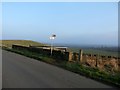
1
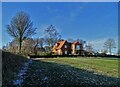
House on the Hill
By Warren Lane, close to Staincross
Image: © Neil Theasby
Taken: 4 Jan 2022
0.07 miles
2
Wheatley Wood to Warren Lane
The white dots left of the centre line trees, are houses on Limes Avenue, Staincross.
Image: © John Fielding
Taken: 3 Jul 2007
0.07 miles
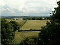
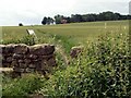
4
Warren Lane to Staincross Common Footpath
Image: © John Fielding
Taken: 12 May 2007
0.10 miles
5
Footpath Adjoining Warren Lane
This lane also marks out the county boundary between South and West Yorkshire.
Image: © Jonathan Clitheroe
Taken: 13 Feb 2017
0.13 miles
6
Footpath to Warren Lane from Woodhouse Lane
Image: © John Fielding
Taken: 20 Jun 2007
0.14 miles
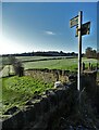
7
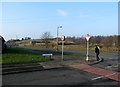
Road Junction near Warren Farm
This is actually a crossroads where Warren Lane continues towards the farm out of shot on the right.
Image: © Jonathan Clitheroe
Taken: 13 Feb 2017
0.16 miles
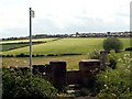
8
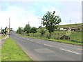
Warren Lane to the A61
The A61 Wakefield left Barnsley right is at the front of the houses.
Image: © John Fielding
Taken: 12 May 2007
0.22 miles
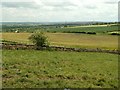
9
Staincross Common
From the intersection at Windhill Lane, looking northwest, one can see the speed camera in the distance.
Image: © Roger May
Taken: 28 May 2006
0.22 miles
10
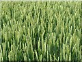
Ear to Ear
A corn field on Woodhouse Lane
Image: © John Fielding
Taken: 20 Jun 2007
0.24 miles