IMAGES TAKEN NEAR TO
Woodhead Lane, BARNSLEY, S74 9SY
Introduction
This page details the photographs taken nearby to Woodhead Lane, S74 9SY by members of the Geograph project.
The Geograph project started in 2005 with the aim of publishing, organising and preserving representative images for every square kilometre of Great Britain, Ireland and the Isle of Man.

There are currently over 7.5m images from over14,400 individuals and you can help contribute to the project by visiting https://www.geograph.org.uk
Image Map
Images are licensed for reuse under creativecommons.org/licenses/by-sa/2.0
Notes
- Clicking on the map will re-center to the selected point.
- The higher the marker number, the further away the image location is from the centre of the postcode.
Image Listing (8 Images Found)
Images are licensed for reuse under creativecommons.org/licenses/by-sa/2.0
Image
Details
Distance
1
Triangulation Pillar at the western edge of Wombwell Wood
This pillar is in poor condition and may have even been moved from its original position. Never mind - the views across to the west from here are some of the most expansive in the county.
Image: © Jonathan Clitheroe
Taken: 12 Jul 2008
0.15 miles
2
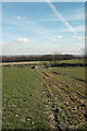
Looking towards Woodhead Lane
On the footpath to Blacker Hill, with Wombwell Wood in the middle distance.
Image: © Chris Yeates
Taken: 22 Mar 2006
0.19 miles
4
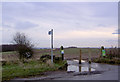
Footpath sign to Wombwell Woods
The forestry commission is creating walks and car parking into Wombwell woods. This area was recently open cast coal mined.
Image: © Steve Fareham
Taken: 5 Dec 2007
0.19 miles