
IMAGES TAKEN NEAR TO
Wath Road, BARNSLEY, S74 8HR
Introduction
This page details the photographs taken nearby to Wath Road, S74 8HR by members of the Geograph project.
The Geograph project started in 2005 with the aim of publishing, organising and preserving representative images for every square kilometre of Great Britain, Ireland and the Isle of Man.

There are currently over 7.5m images from over14,400 individuals and you can help contribute to the project by visiting https://www.geograph.org.uk
Image Map
Images are licensed for reuse under creativecommons.org/licenses/by-sa/2.0
Notes
- Clicking on the map will re-center to the selected point.
- The higher the marker number, the further away the image location is from the centre of the postcode.
Image Listing (237 Images Found)
Images are licensed for reuse under creativecommons.org/licenses/by-sa/2.0
Image
Details
Distance
1
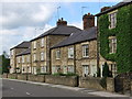
Elsecar - terrace on Wath Road (from east)
Image: © Dave Bevis
Taken: 12 Jun 2010
0.01 miles
2
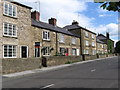
Elsecar - terrace on Wath Road (from south)
Image: © Dave Bevis
Taken: 12 Jun 2010
0.02 miles
3
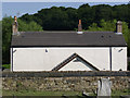
Three Chimneys . . .
. . . but no windows on this side at least. "Three Chimneys" cottage on Wath Road, Elsecar
Image: © Alan Murray-Rust
Taken: 8 Jul 2013
0.02 miles
4
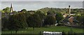
Elsecar
The village of Elsecar, as seen from Elsecar Park. The chimney is at the Heritage Centre.
Image: © Dave Pickersgill
Taken: 10 Oct 2013
0.02 miles
5
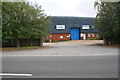
Entrance to industrial units off Wath Road
Image: © Roger Templeman
Taken: 18 Aug 2018
0.03 miles
6
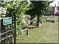
Nether Hoyland (Elsecar) Cemetery
The presence of a single wartime victim has resulted in recognition of the cemetery by the Commonwealth War Graves Commission.
Image: © Alan Murray-Rust
Taken: 8 Jul 2013
0.03 miles
7
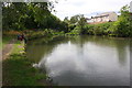
View towards end of canal
Dearne & Dove Canal - Elsecar Branch
Image: © Roger Templeman
Taken: 18 Aug 2018
0.03 miles
8
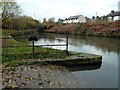
Restored basin on the Brampton Canal
More properly known as the Elsecar Branch of the Dearne and Dove Canal which linked the River Don Navigation with the Barnsley Canal. The Elsecar branch was built to serve the coal mines and so went past many of them. The majority of the towpath is on the Elsecar Greenway, part of the Trans Pennine Trail. Although no longer navigable much of the canal remains in water and there are plans to restore it and a start has been made here at the top basin near the Elsecar Heritage Centre.
Image: © Graham Hogg
Taken: 18 Nov 2011
0.03 miles
9
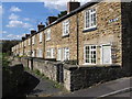
Elsecar - Old Row
See Image for a more distant view.
Image: © Dave Bevis
Taken: 31 Aug 2010
0.04 miles
10
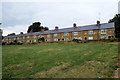
Elsecar, Old Row
A row of fifteen terraced (miners'?) cottages at Elscar. Built in the early nineteenth century, the row is Grade II-listed (Historic England List entry Number: 1151094 https://historicengland.org.uk/listing/the-list/list-entry/1151094 ).
Image: © David Dixon
Taken: 20 Aug 2018
0.04 miles