IMAGES TAKEN NEAR TO
Springwood Road, BARNSLEY, S74 0AZ
Introduction
This page details the photographs taken nearby to Springwood Road, S74 0AZ by members of the Geograph project.
The Geograph project started in 2005 with the aim of publishing, organising and preserving representative images for every square kilometre of Great Britain, Ireland and the Isle of Man.

There are currently over 7.5m images from over14,400 individuals and you can help contribute to the project by visiting https://www.geograph.org.uk
Image Map
Images are licensed for reuse under creativecommons.org/licenses/by-sa/2.0
Notes
- Clicking on the map will re-center to the selected point.
- The higher the marker number, the further away the image location is from the centre of the postcode.
Image Listing (25 Images Found)
Images are licensed for reuse under creativecommons.org/licenses/by-sa/2.0
Image
Details
Distance
2
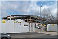
B6097 Fearnley Road
Approaching Kirk Balk Community College.
Image: © J.Hannan-Briggs
Taken: 15 Jun 2014
0.11 miles
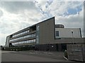
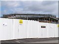
5
'All is revealed' on West Street, Hoyland
Image: © Terry Robinson
Taken: 14 Mar 2010
0.13 miles

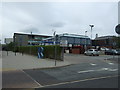
7
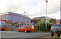
A now dated looking Hoyland sports centre.
Image: © Steve Fareham
Taken: 20 Sep 2007
0.13 miles
9
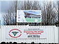
Site for Kirk Balk ALC, West Street, Hoyland
Image: © Terry Robinson
Taken: 14 Mar 2010
0.14 miles
10
'All will be revealed' on West Street, Hoyland
Image: © Terry Robinson
Taken: 14 Mar 2010
0.14 miles