IMAGES TAKEN NEAR TO
School Street, BARNSLEY, S73 9EZ
Introduction
This page details the photographs taken nearby to School Street, S73 9EZ by members of the Geograph project.
The Geograph project started in 2005 with the aim of publishing, organising and preserving representative images for every square kilometre of Great Britain, Ireland and the Isle of Man.

There are currently over 7.5m images from over14,400 individuals and you can help contribute to the project by visiting https://www.geograph.org.uk
Image Map
Images are licensed for reuse under creativecommons.org/licenses/by-sa/2.0
Notes
- Clicking on the map will re-center to the selected point.
- The higher the marker number, the further away the image location is from the centre of the postcode.
Image Listing (121 Images Found)
Images are licensed for reuse under creativecommons.org/licenses/by-sa/2.0
Image
Details
Distance
1
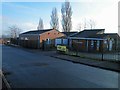
Darfield Children's Centre, Shroggs Head
The site of this centre and the cluster of bungalow's belonging in whole or part to the housing association Guinness Northern Counties, was a former infants School.
The bungalows were first occupied in 1993.
Image: © Steve Fareham
Taken: 13 Jan 2013
0.02 miles
2
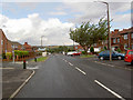
Nanny Marr Road.
Used to be called New County Way.
Image: © Steve Fareham
Taken: 13 Aug 2007
0.03 miles
4
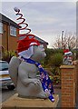
Santa's little helpers are still on duty
Image: © Steve Fareham
Taken: 4 Jan 2009
0.04 miles
5
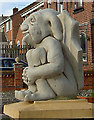
Cheeky or scary grin?
Gatepost ornament on Nanny Marr Road.
Image: © Steve Fareham
Taken: 30 Mar 2008
0.04 miles
6
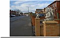
Keeping guard on Nanny Marr Road
See Image for close up.
Image: © Steve Fareham
Taken: 30 Mar 2008
0.05 miles
7
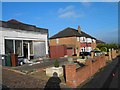
The former Co-operative building on Nanny Marr Road
This has been used as a woodworking business for many years. I guess the co-op closed in the 1960s?
Image: © Steve Fareham
Taken: 13 Jan 2013
0.05 miles
8
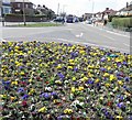
Spring arrives on Nanny Marr Road (Darfield Ring)
Image: © Steve Fareham
Taken: 20 Apr 2013
0.05 miles
9
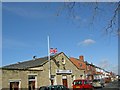
Darfield Conservative Club
Flag is at half mast as a mark of respect for a member who has just died. Next door is Amy's (was Gordon's) fish and chip shop.
Image: © Steve Fareham
Taken: 30 Mar 2008
0.05 miles
10
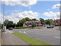
Darfield Ring.
Roundabout that it is a T junction on the A635.
Image: © Steve Fareham
Taken: 22 Jul 2007
0.05 miles