IMAGES TAKEN NEAR TO
Quern Way, BARNSLEY, S73 9DS
Introduction
This page details the photographs taken nearby to Quern Way, S73 9DS by members of the Geograph project.
The Geograph project started in 2005 with the aim of publishing, organising and preserving representative images for every square kilometre of Great Britain, Ireland and the Isle of Man.

There are currently over 7.5m images from over14,400 individuals and you can help contribute to the project by visiting https://www.geograph.org.uk
Image Map
Images are licensed for reuse under creativecommons.org/licenses/by-sa/2.0
Notes
- Clicking on the map will re-center to the selected point.
- The higher the marker number, the further away the image location is from the centre of the postcode.
Image Listing (39 Images Found)
Images are licensed for reuse under creativecommons.org/licenses/by-sa/2.0
Image
Details
Distance
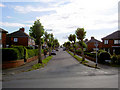
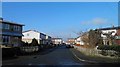
1

Morrison Road shops
The phone box on the green has gone. The shops on the right have had a variety of uses hairdressers, paper shop and ...the left shops have remained as fish and chips and a general store.
Image: © Steve Fareham
Taken: 13 Jan 2013
0.12 miles
2
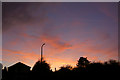
Darfield Sunset
Sunset over Saltersbrook Road Darfield.
Image: © Steve Fareham
Taken: 3 Nov 2007
0.13 miles
3
The junction of Illsley Road and Woodhall Road, Darfield
Image: © Steve Fareham
Taken: 13 Jan 2013
0.14 miles
4
Destroyed bus shelter
The bus shelter on Saltersbrook Road seems to have been hit by a vehicle.
Image: © Steve Fareham
Taken: 24 Dec 2013
0.14 miles
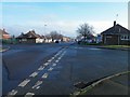
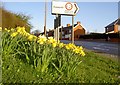
5
Edderthorpe benches.
Junction with A635.
Image: © Steve Fareham
Taken: 6 Aug 2007
0.15 miles
7
Turn right to Cudworth
Junction to Edderthorpe Lane from the A635.
Image: © Steve Fareham
Taken: 30 Mar 2008
0.16 miles
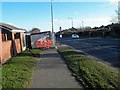
8
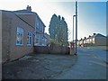
Post box outside former shop
At the junction of North Street and Illsley Road. The part of the building nearest the viewer was the shop and it's been derelict for years and recently turned into an extension to the house. In the 1960s it was called Ennis's shop.
Image: © Steve Fareham
Taken: 13 Jan 2013
0.16 miles
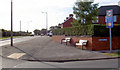
9
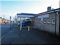
Darfield Community Centre on Illsley Road
For many years it was known as (and still is to many) as Darfield Old Folks Centre. It was used by all sorts of groups.
Image: © Steve Fareham
Taken: 13 Jan 2013
0.16 miles
10
Clarney Place Darfield
A cul de sac composed of modular 'Tarran Houses'. The street is named after Mr Henry Clarney a prominent former councillor.
Tarran houses were built after the second world war and were designed by building firm Tarran Industries Ltd. of Hull. A steel frame designed house over clad with precast concrete panels. 19,014 Tarrans were erected under the Temporary Housing act, but one- and two-storey variants were built in some numbers afterwards.
Image: © Steve Fareham
Taken: 13 Jan 2013
0.17 miles