IMAGES TAKEN NEAR TO
The Paddock, BARNSLEY, S73 9BD
Introduction
This page details the photographs taken nearby to The Paddock, S73 9BD by members of the Geograph project.
The Geograph project started in 2005 with the aim of publishing, organising and preserving representative images for every square kilometre of Great Britain, Ireland and the Isle of Man.

There are currently over 7.5m images from over14,400 individuals and you can help contribute to the project by visiting https://www.geograph.org.uk
Image Map
Images are licensed for reuse under creativecommons.org/licenses/by-sa/2.0
Notes
- Clicking on the map will re-center to the selected point.
- The higher the marker number, the further away the image location is from the centre of the postcode.
Image Listing (63 Images Found)
Images are licensed for reuse under creativecommons.org/licenses/by-sa/2.0
Image
Details
Distance
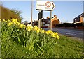
1
Edderthorpe benches.
Junction with A635.
Image: © Steve Fareham
Taken: 6 Aug 2007
0.07 miles
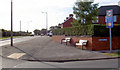
2
Turn right to Cudworth
Junction to Edderthorpe Lane from the A635.
Image: © Steve Fareham
Taken: 30 Mar 2008
0.08 miles
3
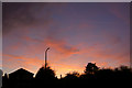
Darfield Sunset
Sunset over Saltersbrook Road Darfield.
Image: © Steve Fareham
Taken: 3 Nov 2007
0.08 miles
4
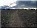
Footpath up the 'fields'
With houses on Edderthorpe Lane on the horizon.
Image: © Steve Fareham
Taken: 28 Aug 2008
0.09 miles
5
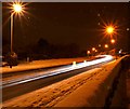
The A635 trunk road with snow at night #2
Looking towards Barnsley.
Image: © Steve Fareham
Taken: 2 Feb 2009
0.11 miles
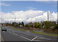
6
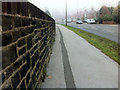
A misty Saltersbrook (Doncaster Road A635) Darfield
Image: © Steve Fareham
Taken: 21 Oct 2012
0.12 miles
8
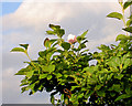
Must be climate change
Magnolia flower in August?
Image: © Steve Fareham
Taken: 14 Aug 2007
0.12 miles
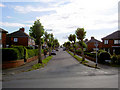
9
A635, Saltersbrook Road, Doncaster Road.
Image: © Steve Fareham
Taken: 13 Aug 2007
0.12 miles
10
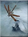
In the deep midwinter
Ice covered fish pond.
Image: © Steve Fareham
Taken: 26 Dec 2010
0.13 miles