
IMAGES TAKEN NEAR TO
Kingfisher Drive, BARNSLEY, S73 0UX
Introduction
This page details the photographs taken nearby to Kingfisher Drive, S73 0UX by members of the Geograph project.
The Geograph project started in 2005 with the aim of publishing, organising and preserving representative images for every square kilometre of Great Britain, Ireland and the Isle of Man.

There are currently over 7.5m images from over14,400 individuals and you can help contribute to the project by visiting https://www.geograph.org.uk
Image Map
Images are licensed for reuse under creativecommons.org/licenses/by-sa/2.0
Notes
- Clicking on the map will re-center to the selected point.
- The higher the marker number, the further away the image location is from the centre of the postcode.
Image Listing (26 Images Found)
Images are licensed for reuse under creativecommons.org/licenses/by-sa/2.0
Image
Details
Distance
1
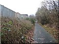
Alongside the back gardens of Kingfisher Drive
The Elsecar Greenway on the northern edge of Brampton.
Image: © Christine Johnstone
Taken: 5 Feb 2017
0.01 miles
2

Cycle path beside RSPB Gypsey Marsh
National Cycle Network routes 67 and 62 running along the former Penistone and Doncaster railway line.
Image: © DS Pugh
Taken: 13 Apr 2025
0.09 miles
3
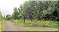
Junction of Trans Pennine Trail and Elsecar Greenway.
Image: © Steve Fareham
Taken: 17 Aug 2007
0.09 miles
4
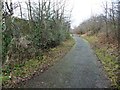
Elsecar Greenway, looking west
The former Elsecar railway line, now a traffic-free cycleway and footpath.
Image: © Christine Johnstone
Taken: 5 Feb 2017
0.10 miles
5

Dearne Valley Parkway Bridge
National Cycle Network route 62 running along the former Penistone and Doncaster railway line.
Image: © DS Pugh
Taken: 13 Apr 2025
0.10 miles
6
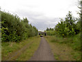
Dearne Valley parkway road bridge over Trans Pennine Trail.
Image: © Steve Fareham
Taken: 17 Aug 2007
0.10 miles
7

Public footpath to Gypsy Marsh
Gypsy Marsh is an RSPB reserve - meadow with fen at one end, dry grassland at the other. This path is shown on the large sale OS map surveyed in 1850, running east from the canal junction at Wombwell.
Image: © Christine Johnstone
Taken: 19 Mar 2022
0.11 miles
8
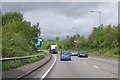
A6195 north of Brampton
Approaching Wath Road roundabout.
Image: © Julian P Guffogg
Taken: 21 May 2016
0.14 miles
9
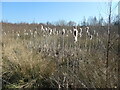
Reed mace at Gypsy Marsh
Gypsy Marsh is an RSPB reserve - a meadow with fen at one end, dry grassland at the other.
Image: © Christine Johnstone
Taken: 19 Mar 2022
0.15 miles
10

Scrub at Gypsy Marsh
Gypsy Marsh is an RSPB reserve - a meadow with fen at one end, dry grassland at the other.
Image: © Christine Johnstone
Taken: 19 Mar 2022
0.15 miles