
IMAGES TAKEN NEAR TO
Everill Gate, S73 0FJ
Introduction
This page details the photographs taken nearby to Everill Gate, S73 0FJ by members of the Geograph project.
The Geograph project started in 2005 with the aim of publishing, organising and preserving representative images for every square kilometre of Great Britain, Ireland and the Isle of Man.

There are currently over 7.5m images from over14,400 individuals and you can help contribute to the project by visiting https://www.geograph.org.uk
Image Map
Images are licensed for reuse under creativecommons.org/licenses/by-sa/2.0
Notes
- Clicking on the map will re-center to the selected point.
- The higher the marker number, the further away the image location is from the centre of the postcode.
Image Listing (16 Images Found)
Images are licensed for reuse under creativecommons.org/licenses/by-sa/2.0
Image
Details
Distance
1
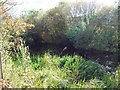
Disused Canal near Valley Way
The Dearne and Dove Canal is all but lost amid the new roads and developments in this area but it can be seen here by a grassy clearing close to the A633.
Image: © Jonathan Clitheroe
Taken: 7 Oct 2011
0.07 miles
2

Cycle path beside Everill Gate Lane
National Cycle Network routes 67 and 62 running along the former Penistone and Doncaster railway line.
Image: © DS Pugh
Taken: 13 Apr 2025
0.07 miles
3

Everill Lane Bridge
National Cycle Network routes 67 and 62 running along the former Penistone and Doncaster railway line.
Image: © DS Pugh
Taken: 13 Apr 2025
0.08 miles
4
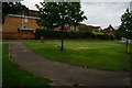
Houses on Wath Road
Taken from Brampton Road.
Image: © Ian S
Taken: 31 May 2014
0.10 miles
5
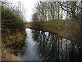
The Dearne & Dove Canal, west of Junction Bridge
The canal was built to carry coal from local collieries. It officially closed in 1961.
Image: © Christine Johnstone
Taken: 5 Feb 2017
0.11 miles
6

Cycle path approaching Everill Gate Lane
National Cycle Network routes 67 and 62 running along the former Penistone and Doncaster railway line.
Image: © DS Pugh
Taken: 13 Apr 2025
0.11 miles
7
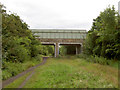
Broomhill road bridge over Trans Pennine Trail.
Image: © Steve Fareham
Taken: 17 Aug 2007
0.12 miles
8
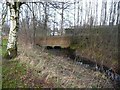
Junction Bridge
Carrying the A633 [Wath Road] over the remains of the Dearne & Dove Canal.
Image: © Christine Johnstone
Taken: 5 Feb 2017
0.13 miles
9

Cycle path north of Everill Gate Lane
National Cycle Network routes 67 and 62 running along the former Penistone and Doncaster railway line.
Image: © DS Pugh
Taken: 13 Apr 2025
0.14 miles
10
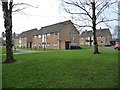
Flats on Junction Close, off Junction Street
Named after the junction of the Dearne & Dove Canal and its Elsecar branch {Wombwell Junction}, which was approximately just behind the photographer.
Image: © Christine Johnstone
Taken: 5 Feb 2017
0.15 miles