IMAGES TAKEN NEAR TO
Moor Lane, BARNSLEY, S72 9LX
Introduction
This page details the photographs taken nearby to Moor Lane, S72 9LX by members of the Geograph project.
The Geograph project started in 2005 with the aim of publishing, organising and preserving representative images for every square kilometre of Great Britain, Ireland and the Isle of Man.

There are currently over 7.5m images from over14,400 individuals and you can help contribute to the project by visiting https://www.geograph.org.uk
Image Map
Images are licensed for reuse under creativecommons.org/licenses/by-sa/2.0
Notes
- Clicking on the map will re-center to the selected point.
- The higher the marker number, the further away the image location is from the centre of the postcode.
Image Listing (9 Images Found)
Images are licensed for reuse under creativecommons.org/licenses/by-sa/2.0
Image
Details
Distance
1
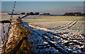
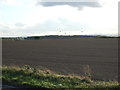
Ringstone Hill
Reservoir and farm on the hill top. Late afternoon sun highlights the landscape.
Image: © Wendy North
Taken: 15 Jan 2013
0.03 miles
2
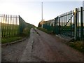
Ringstone Hill
Bagged old top at Hargate Hill then Ringstone Hill with Martin Richardson.
Name: Ringstone Hill
Hill number: 16834
Height: 119m / 390ft
Parent (Ma/M): 2810 Black Hill
Section: 36: Lancashire, Cheshire & the Southern Pennines
County/UA: Barnsley (UA)
Class: Tump (100-199m)
Grid ref: SE425099 (est)
Drop: 53m
Col: 66m SE367137
Image: © Rude Health
Taken: 23 Nov 2014
0.04 miles
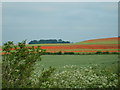
7
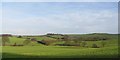
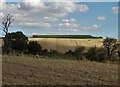
Gently rolling countryside.
Along the Barnsley boundary walk.
Image: © steven ruffles
Taken: 27 Jan 2012
0.18 miles