IMAGES TAKEN NEAR TO
Brierley Gap, BARNSLEY, S72 9HA
Introduction
This page details the photographs taken nearby to Brierley Gap, S72 9HA by members of the Geograph project.
The Geograph project started in 2005 with the aim of publishing, organising and preserving representative images for every square kilometre of Great Britain, Ireland and the Isle of Man.

There are currently over 7.5m images from over14,400 individuals and you can help contribute to the project by visiting https://www.geograph.org.uk
Image Map
Images are licensed for reuse under creativecommons.org/licenses/by-sa/2.0
Notes
- Clicking on the map will re-center to the selected point.
- The higher the marker number, the further away the image location is from the centre of the postcode.
Image Listing (7 Images Found)
Images are licensed for reuse under creativecommons.org/licenses/by-sa/2.0
Image
Details
Distance
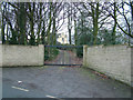
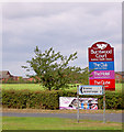
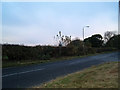
2
The Robin Hood, Brierley Gap
There is a for sale sign at the locked gates on Common Road. The former pub / night club will be auctioned in December 2012. The guide starting price is £750,000.
Image: © Christine Johnstone
Taken: 10 Nov 2012
0.01 miles
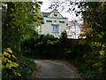
3
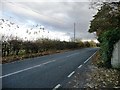
Common Lane, Brierley Gap
East of Southmoor Road [the B6273].
Image: © Christine Johnstone
Taken: 10 Nov 2012
0.04 miles
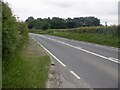
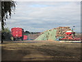
5
Road junction near Brierley Gap
Road from South Kirkby near the dumpit site.
Image: © Steve Fareham
Taken: 3 Nov 2007
0.17 miles