IMAGES TAKEN NEAR TO
Holmsley Lane, BARNSLEY, S72 9EX
Introduction
This page details the photographs taken nearby to Holmsley Lane, S72 9EX by members of the Geograph project.
The Geograph project started in 2005 with the aim of publishing, organising and preserving representative images for every square kilometre of Great Britain, Ireland and the Isle of Man.

There are currently over 7.5m images from over14,400 individuals and you can help contribute to the project by visiting https://www.geograph.org.uk
Image Map
Images are licensed for reuse under creativecommons.org/licenses/by-sa/2.0
Notes
- Clicking on the map will re-center to the selected point.
- The higher the marker number, the further away the image location is from the centre of the postcode.
Image Listing (11 Images Found)
Images are licensed for reuse under creativecommons.org/licenses/by-sa/2.0
Image
Details
Distance
1
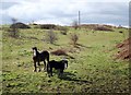
Iron Age site, South Kirkby
These horses are grazing in the area inside the enclosure, which is defined by a ditch and bank.
Image: © David Pickersgill
Taken: 19 Mar 2008
0.08 miles
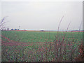
3
Iron Age site, South Kirkby
Showing the ditch and bank at the western extremity of the enclosure.
Image: © David Pickersgill
Taken: 19 Mar 2008
0.11 miles
4
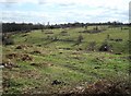
Iron Age site, South Kirkby
Probably not a hill fort as once believed, because it's on the side of a hill not the summit (which is several hundred yards to the west) and there has been little evidence found of human activity. More likely a defensive enclosure from the years prior to the Roman invasion.
Image: © David Pickersgill
Taken: 19 Mar 2008
0.12 miles
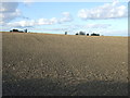
5
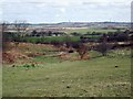
Iron Age site, South Kirkby
Showing the sloping nature of the enclosure (another reason why it's probably not a hill fort) and the extensive view to the north-east. Upton on the hillside in the middle distance, steam plumes from Ferrybridge (left) and Eggborough (right) power stations on the horizon.
Image: © David Pickersgill
Taken: 19 Mar 2008
0.14 miles
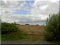
6
Settlement west side of South Kirkby
Image: © Richard Spencer
Taken: 5 Feb 2006
0.14 miles
7
Iron Age site, South Kirkby
The top of the bank on the southern edge of the enclosure.
Image: © David Pickersgill
Taken: 19 Mar 2008
0.15 miles
8
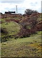
Iron Age site, South Kirkby
Ditch and banks on the south-eastern edge of the enclosure.
Image: © David Pickersgill
Taken: 19 Mar 2008
0.17 miles
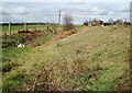
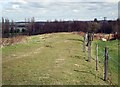
10
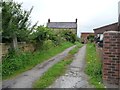
Entrance to Kirkby Common Farm
On the north side of Common Road.
Image: © Christine Johnstone
Taken: 1 Aug 2012
0.24 miles