IMAGES TAKEN NEAR TO
Netherfield Croft, BARNSLEY, S72 8WH
Introduction
This page details the photographs taken nearby to Netherfield Croft, S72 8WH by members of the Geograph project.
The Geograph project started in 2005 with the aim of publishing, organising and preserving representative images for every square kilometre of Great Britain, Ireland and the Isle of Man.

There are currently over 7.5m images from over14,400 individuals and you can help contribute to the project by visiting https://www.geograph.org.uk
Image Map
Images are licensed for reuse under creativecommons.org/licenses/by-sa/2.0
Notes
- Clicking on the map will re-center to the selected point.
- The higher the marker number, the further away the image location is from the centre of the postcode.
Image Listing (37 Images Found)
Images are licensed for reuse under creativecommons.org/licenses/by-sa/2.0
Image
Details
Distance
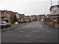
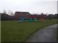
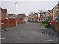
2
Broomcliffe Gardens - Plumpton Park
Image: © Betty Longbottom
Taken: 10 Feb 2017
0.05 miles
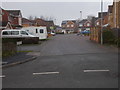
5
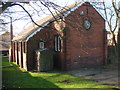
Former Chapel on High Street, Shafton, now a dwelling.
Image: © Bill Henderson
Taken: 29 Nov 2006
0.09 miles
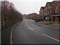
7
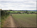
Footpath towards Three Nooks and Upper Cudworth
Image: © John Slater
Taken: 5 Oct 2013
0.10 miles
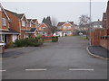
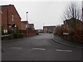
10

Plumpton Park - viewed from High Gate Way
Image: © Betty Longbottom
Taken: 10 Feb 2017
0.12 miles