IMAGES TAKEN NEAR TO
Engine Lane, BARNSLEY, S72 8RD
Introduction
This page details the photographs taken nearby to Engine Lane, S72 8RD by members of the Geograph project.
The Geograph project started in 2005 with the aim of publishing, organising and preserving representative images for every square kilometre of Great Britain, Ireland and the Isle of Man.

There are currently over 7.5m images from over14,400 individuals and you can help contribute to the project by visiting https://www.geograph.org.uk
Image Map
Images are licensed for reuse under creativecommons.org/licenses/by-sa/2.0
Notes
- Clicking on the map will re-center to the selected point.
- The higher the marker number, the further away the image location is from the centre of the postcode.
Image Listing (6 Images Found)
Images are licensed for reuse under creativecommons.org/licenses/by-sa/2.0
Image
Details
Distance
1

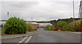
Industrial estate entrance off Engine Lane
Image: © Steve Fareham
Taken: 27 Dec 2015
0.08 miles
2
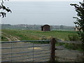
This was the former NCB stores
NCB National Coal Board, in the hey day of mining this store held million's of pounds worth of spares and equipment.
Image: © Steve Fareham
Taken: 14 Oct 2007
0.11 miles
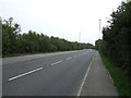
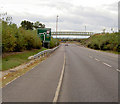
5
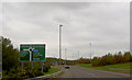
Engine Lane roundabout
On the new Shafton bypass.
Image: © Steve Fareham
Taken: 14 Oct 2007
0.21 miles