IMAGES TAKEN NEAR TO
Abbey Grove, BARNSLEY, S71 5HW
Introduction
This page details the photographs taken nearby to Abbey Grove, S71 5HW by members of the Geograph project.
The Geograph project started in 2005 with the aim of publishing, organising and preserving representative images for every square kilometre of Great Britain, Ireland and the Isle of Man.

There are currently over 7.5m images from over14,400 individuals and you can help contribute to the project by visiting https://www.geograph.org.uk
Image Map
Images are licensed for reuse under creativecommons.org/licenses/by-sa/2.0
Notes
- Clicking on the map will re-center to the selected point.
- The higher the marker number, the further away the image location is from the centre of the postcode.
Image Listing (8 Images Found)
Images are licensed for reuse under creativecommons.org/licenses/by-sa/2.0
Image
Details
Distance
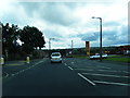
3
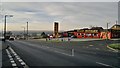
Pontefract Road, Lundwood
A demolished pub, The Lundwood,is behind the Motosave premises, which may occupy a former filling station site? The cleared site is ready for redevelopment, probably as flats.
Image: © Chris Morgan
Taken: 30 Nov 2012
0.18 miles
5
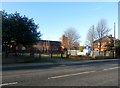
St Mary Magdalene Church in Lundwood
Pictured from Lund Lane.
Image: © Jonathan Clitheroe
Taken: 4 Jan 2017
0.23 miles
6
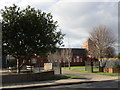
The church of St. Mary Magdalene, Lundwood
Image: © Jonathan Thacker
Taken: 19 Mar 2018
0.24 miles
7
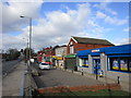
Shops on Pontefract Road, Lundwood
Image: © Jonathan Thacker
Taken: 19 Mar 2018
0.25 miles