IMAGES TAKEN NEAR TO
The Brambles, BARNSLEY, S71 4TA
Introduction
This page details the photographs taken nearby to The Brambles, S71 4TA by members of the Geograph project.
The Geograph project started in 2005 with the aim of publishing, organising and preserving representative images for every square kilometre of Great Britain, Ireland and the Isle of Man.

There are currently over 7.5m images from over14,400 individuals and you can help contribute to the project by visiting https://www.geograph.org.uk
Image Map (Loading...)


Getting Data...Please wait
Leaflet Map data © OpenStreetMap
Images are licensed for reuse under creativecommons.org/licenses/by-sa/2.0
Notes
- Clicking on the map will re-center to the selected point.
- The higher the marker number, the further away the image location is from the centre of the postcode.
Image Listing (32 Images Found)
Images are licensed for reuse under creativecommons.org/licenses/by-sa/2.0
Image
Details
Distance
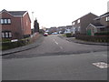
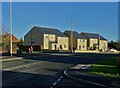
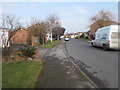
2
Applehaigh Grove - Applehaigh View
Image: © Betty Longbottom
Taken: 14 Feb 2017
0.06 miles
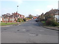
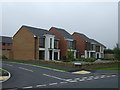
4
New houses on Lee Lane, Royston
With a woman on a mobility scooter heading west.
Image: © Neil Theasby
Taken: 4 Jan 2022
0.07 miles
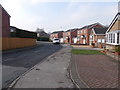
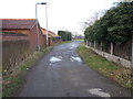
7
Lee Lane - viewed from Applehaigh View
Image: © Betty Longbottom
Taken: 14 Feb 2017
0.11 miles
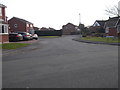
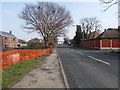
9
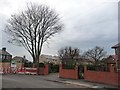
Building site on the corner of Back Lane West
New houses going in between this corner and Lee Lane.
Image: © Christine Johnstone
Taken: 9 Feb 2011
0.11 miles