IMAGES TAKEN NEAR TO
Northlands, BARNSLEY, S71 4JB
Introduction
This page details the photographs taken nearby to Northlands, S71 4JB by members of the Geograph project.
The Geograph project started in 2005 with the aim of publishing, organising and preserving representative images for every square kilometre of Great Britain, Ireland and the Isle of Man.

There are currently over 7.5m images from over14,400 individuals and you can help contribute to the project by visiting https://www.geograph.org.uk
Image Map
Images are licensed for reuse under creativecommons.org/licenses/by-sa/2.0
Notes
- Clicking on the map will re-center to the selected point.
- The higher the marker number, the further away the image location is from the centre of the postcode.
Image Listing (45 Images Found)
Images are licensed for reuse under creativecommons.org/licenses/by-sa/2.0
Image
Details
Distance
4
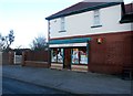
General Store in Royston
This traditional store and off-licence can be found on Station Road.
Image: © Jonathan Clitheroe
Taken: 14 Jan 2017
0.08 miles
6
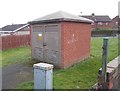
Electricity Substation No 2341 - Station Road
Image: © Betty Longbottom
Taken: 10 Jan 2017
0.09 miles
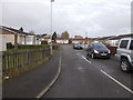
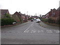
7
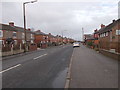
Station Road - viewed from Common Lane
Image: © Betty Longbottom
Taken: 10 Jan 2017
0.09 miles
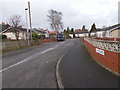
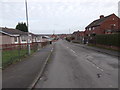
8
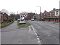
Station Road - viewed from Common Lane
Image: © Betty Longbottom
Taken: 10 Jan 2017
0.10 miles