IMAGES TAKEN NEAR TO
Galway Close, BARNSLEY, S71 4FR
Introduction
This page details the photographs taken nearby to Galway Close, S71 4FR by members of the Geograph project.
The Geograph project started in 2005 with the aim of publishing, organising and preserving representative images for every square kilometre of Great Britain, Ireland and the Isle of Man.

There are currently over 7.5m images from over14,400 individuals and you can help contribute to the project by visiting https://www.geograph.org.uk
Image Map
Images are licensed for reuse under creativecommons.org/licenses/by-sa/2.0
Notes
- Clicking on the map will re-center to the selected point.
- The higher the marker number, the further away the image location is from the centre of the postcode.
Image Listing (58 Images Found)
Images are licensed for reuse under creativecommons.org/licenses/by-sa/2.0
Image
Details
Distance
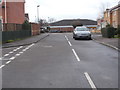
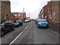
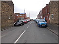
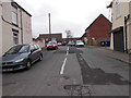
2
Strawberry Gardens - looking towards Midland Road
Image: © Betty Longbottom
Taken: 10 Jan 2017
0.01 miles
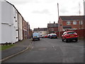
5
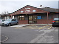
Royston Group Practice - Midland Road
Image: © Betty Longbottom
Taken: 10 Jan 2017
0.03 miles
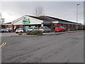
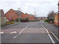
10
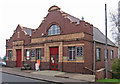
Royston - Salvation Army citadel
On Midland Road. For an alternative view, please see Image
Image: © Dave Bevis
Taken: 2 Dec 2013
0.08 miles