IMAGES TAKEN NEAR TO
Robin Lane, BARNSLEY, S71 4EA
Introduction
This page details the photographs taken nearby to Robin Lane, S71 4EA by members of the Geograph project.
The Geograph project started in 2005 with the aim of publishing, organising and preserving representative images for every square kilometre of Great Britain, Ireland and the Isle of Man.

There are currently over 7.5m images from over14,400 individuals and you can help contribute to the project by visiting https://www.geograph.org.uk
Image Map
Images are licensed for reuse under creativecommons.org/licenses/by-sa/2.0
Notes
- Clicking on the map will re-center to the selected point.
- The higher the marker number, the further away the image location is from the centre of the postcode.
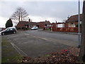
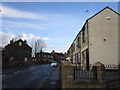
Image Listing (45 Images Found)
Images are licensed for reuse under creativecommons.org/licenses/by-sa/2.0
Image
Details
Distance
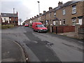
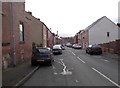
2
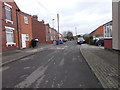
Robin Hood Avenue - Poplar Terrace
Image: © Betty Longbottom
Taken: 10 Jan 2017
0.09 miles
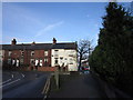
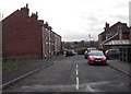
10
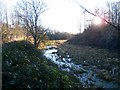
The Barnsley Canal near Royston
The Barnsley Canal was opened in 1798 in order to transport coal from the Barnsley coal fields to the River Calder and beyond. It last saw traffic in 1950 and closed three years later. The track on the left is part of the Trans Pennine Trail.
Image: © Jonathan Clitheroe
Taken: 14 Jan 2017
0.16 miles