IMAGES TAKEN NEAR TO
Godley Street, BARNSLEY, S71 4DH
Introduction
This page details the photographs taken nearby to Godley Street, S71 4DH by members of the Geograph project.
The Geograph project started in 2005 with the aim of publishing, organising and preserving representative images for every square kilometre of Great Britain, Ireland and the Isle of Man.

There are currently over 7.5m images from over14,400 individuals and you can help contribute to the project by visiting https://www.geograph.org.uk
Image Map
Images are licensed for reuse under creativecommons.org/licenses/by-sa/2.0
Notes
- Clicking on the map will re-center to the selected point.
- The higher the marker number, the further away the image location is from the centre of the postcode.
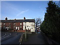
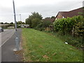
Image Listing (59 Images Found)
Images are licensed for reuse under creativecommons.org/licenses/by-sa/2.0
Image
Details
Distance
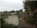
2

Allotments and pigeon lofts in Royston
Seen from the Trans Pennine Trail which here runs on the bank of the disused Barnsley Canal
Image: © Graham Hogg
Taken: 30 Nov 2012
0.07 miles
5
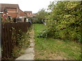
Footpath between Low Croft and Allotments
Image: © Darren Haddock
Taken: 4 Sep 2019
0.08 miles
9
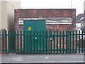
Electricity Substation No 2493 - Midland Road
Image: © Betty Longbottom
Taken: 10 Jan 2017
0.10 miles