
IMAGES TAKEN NEAR TO
East End Crescent, BARNSLEY, S71 4AW
Introduction
This page details the photographs taken nearby to East End Crescent, S71 4AW by members of the Geograph project.
The Geograph project started in 2005 with the aim of publishing, organising and preserving representative images for every square kilometre of Great Britain, Ireland and the Isle of Man.

There are currently over 7.5m images from over14,400 individuals and you can help contribute to the project by visiting https://www.geograph.org.uk
Image Map
Images are licensed for reuse under creativecommons.org/licenses/by-sa/2.0
Notes
- Clicking on the map will re-center to the selected point.
- The higher the marker number, the further away the image location is from the centre of the postcode.
Image Listing (39 Images Found)
Images are licensed for reuse under creativecommons.org/licenses/by-sa/2.0
Image
Details
Distance
1
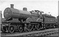
Ex-Midland 4-4-0 at Royston Locomotive Depot
One of the numerous Midland 2P 4-4-0s built by Johnson 1882 - 1901, rebuilt by Deeley from 1912, No.40362 lasted until 12/56. Royston Depot had been built as recently as 3/32, mainly to serve nearby Carlton Sidings; it was coded 20C and in 1950 had an allocation of 62:- 2 4-4-0, 19 2-8-0, 1 0-8-0, 22 0-6-0, 3 2-6-4T, 6 2-6-2T, 5 0-6-0T and 4 0-4-4T.
Image: © Ben Brooksbank
Taken: 10 Apr 1949
0.11 miles
2

Ex-Midland 1P 0-4-4T at Royston Locomotive Depot
No. 1368 (still with LMS livery and number) is fitted for auto-train working, on the Cudworth - Barnsley service: it was built in the 1890s, being one of the large Johnson '2228' class rebuilt with Belpaire boiler by Fowler after Grouping; it survived (as BR No. 58066) until 10/58.
Image: © Ben Brooksbank
Taken: 10 Apr 1949
0.11 miles
3
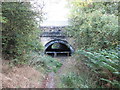
Path under the railway near Pool Ings, Royston
Image: © John Slater
Taken: 5 Oct 2013
0.15 miles
4
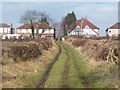
Houses on the north side of Church Hill
Seen from the bridleway from Carlton.
Image: © Christine Johnstone
Taken: 9 Feb 2011
0.17 miles
5
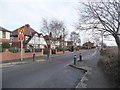
Mind the bollards
Traffic management on Church Hill, Royston.
Image: © Christine Johnstone
Taken: 9 Feb 2011
0.18 miles
6

Barnsley Canal at Royston
The former Barnsley Canal at this point forms part of the Trans Pennine Trail. The Canal was built to serve coal mines in the barnsley area, but railways drained its profitability. It closed finally in 1954.
Image: © Alan Murray-Rust
Taken: 20 May 2007
0.19 miles
7
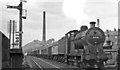
Up freight at Royston & Notton
View northward from the station, towards Normanton and Leeds: ex-Midland Sheffield - Leeds main line, disused since 1968 owing to mining subsidences: the 'C' board marks the commencement of a temporary speed restriction, no doubt due to one of these. (See Image]). The Class H freight is headed by LMS Fowler 4F 0-6-0 No. 44538 (built 1928, withdrawn 1/64). Behind is New Moncton Colliery.
Image: © Ben Brooksbank
Taken: 24 Jul 1951
0.19 miles
8
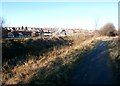
Trans Pennine Trail and Barnsley Canal at Royston
The Barnsley Canal was opened in 1798 in order to transport coal from the Barnsley coal fields to the River Calder and beyond. It last saw traffic in 1950 and closed three years later.
Image: © Jonathan Clitheroe
Taken: 14 Jan 2017
0.19 miles
10

The Barnsley Canal
Looking a bit dry.
Trans Pennine Trail runs beside it.
Image: © JThomas
Taken: 25 Sep 2013
0.20 miles