IMAGES TAKEN NEAR TO
Shaw Lane, BARNSLEY, S71 3HH
Introduction
This page details the photographs taken nearby to Shaw Lane, S71 3HH by members of the Geograph project.
The Geograph project started in 2005 with the aim of publishing, organising and preserving representative images for every square kilometre of Great Britain, Ireland and the Isle of Man.

There are currently over 7.5m images from over14,400 individuals and you can help contribute to the project by visiting https://www.geograph.org.uk
Image Map
Images are licensed for reuse under creativecommons.org/licenses/by-sa/2.0
Notes
- Clicking on the map will re-center to the selected point.
- The higher the marker number, the further away the image location is from the centre of the postcode.
Image Listing (8 Images Found)
Images are licensed for reuse under creativecommons.org/licenses/by-sa/2.0
Image
Details
Distance
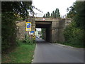
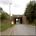
5
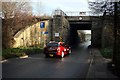
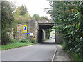
Shaw Viaduct
The bridge once carried the four track Midland Railway between Sheffield and Leeds, but now carries only takes the freight line to Ardagh glass works.
Image: © Graham Hogg
Taken: 30 Nov 2012
0.12 miles
8
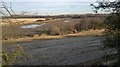
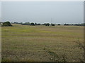
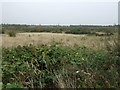
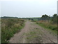
Arable in the former Yorkshire coalfield
Where the disused railways and canals have left more mark than the reclaimed and landscaped collieries.
A frosty morning towards the end of a very wet year.
Image: © Chris Morgan
Taken: 30 Nov 2012
0.25 miles