
IMAGES TAKEN NEAR TO
Rainford Drive, BARNSLEY, S71 2SF
Introduction
This page details the photographs taken nearby to Rainford Drive, S71 2SF by members of the Geograph project.
The Geograph project started in 2005 with the aim of publishing, organising and preserving representative images for every square kilometre of Great Britain, Ireland and the Isle of Man.

There are currently over 7.5m images from over14,400 individuals and you can help contribute to the project by visiting https://www.geograph.org.uk
Image Map
Images are licensed for reuse under creativecommons.org/licenses/by-sa/2.0
Notes
- Clicking on the map will re-center to the selected point.
- The higher the marker number, the further away the image location is from the centre of the postcode.
Image Listing (5 Images Found)
Images are licensed for reuse under creativecommons.org/licenses/by-sa/2.0
Image
Details
Distance

2

Fish Dam Lane
Looking north towards Carlton
Image: © Graham Hogg
Taken: 30 Nov 2012
0.11 miles
3

Green space east of Fish Dam Lane
Some of the chimneys of the glass container works are just visible in the distance. The green space is marked as farmland on older OS maps but now has the appearance of remediated land. There appears to be no map however showing this being a waste site.
Image: © Kevin Waterhouse
Taken: 10 Oct 2025
0.15 miles
4
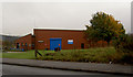
Barnsley Ambulance centre
On Carlton industrial estate.
Image: © Steve Fareham
Taken: 13 Oct 2007
0.22 miles
5

Meandering path on green space
A large green space south of West Green Way which has a meandering path to Fish Dam Lane. Older OS maps have this has farmland but it now appears to have a remediated landscape, but there appears to be no map showing it being a waste site.
Image: © Kevin Waterhouse
Taken: 10 Oct 2025
0.23 miles