IMAGES TAKEN NEAR TO
Bluebell Bank, BARNSLEY, S70 4NJ
Introduction
This page details the photographs taken nearby to Bluebell Bank, S70 4NJ by members of the Geograph project.
The Geograph project started in 2005 with the aim of publishing, organising and preserving representative images for every square kilometre of Great Britain, Ireland and the Isle of Man.

There are currently over 7.5m images from over14,400 individuals and you can help contribute to the project by visiting https://www.geograph.org.uk
Image Map
Images are licensed for reuse under creativecommons.org/licenses/by-sa/2.0
Notes
- Clicking on the map will re-center to the selected point.
- The higher the marker number, the further away the image location is from the centre of the postcode.
Image Listing (12 Images Found)
Images are licensed for reuse under creativecommons.org/licenses/by-sa/2.0
Image
Details
Distance
1
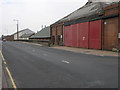
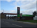
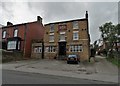
Tracky Garage
Yorkshire Traction, known locally as Tracky, operate from this site on Upper Sheffield Road in Barnsley.
Image: © Michael Patterson
Taken: 5 Jul 2006
0.11 miles
3
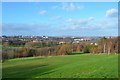
Barnsley - South Yorkshire
A view of Barnsley from a hill overlooking the town.
Image: © Ashley Dace
Taken: 27 Nov 2011
0.18 miles
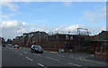
4
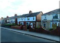
Upper Sheffield Road (A61)
Heading north west towards Barnsley.
Image: © JThomas
Taken: 27 Sep 2014
0.19 miles
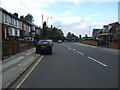
10
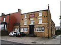
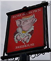
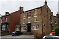
"The Rose and Crown", Mt Vernon Road, Barnsley
Image: © Neil Theasby
Taken: 21 Oct 2017
0.23 miles