
IMAGES TAKEN NEAR TO
Hollin House Lane, SHEFFIELD, S6 6RG
Introduction
This page details the photographs taken nearby to Hollin House Lane, S6 6RG by members of the Geograph project.
The Geograph project started in 2005 with the aim of publishing, organising and preserving representative images for every square kilometre of Great Britain, Ireland and the Isle of Man.

There are currently over 7.5m images from over14,400 individuals and you can help contribute to the project by visiting https://www.geograph.org.uk
Image Map
Images are licensed for reuse under creativecommons.org/licenses/by-sa/2.0
Notes
- Clicking on the map will re-center to the selected point.
- The higher the marker number, the further away the image location is from the centre of the postcode.
Image Listing (52 Images Found)
Images are licensed for reuse under creativecommons.org/licenses/by-sa/2.0
Image
Details
Distance
1
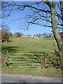
Hollin House Farm
Looking up from Loxley Road at Stacey Bank.
Image: © Alan Murray-Rust
Taken: 27 Mar 2012
0.03 miles



5
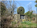
Peak District National Park boundary marker
Beside the B6077 Loxley Road at Stacey Bank
Image: © Graham Hogg
Taken: 30 Mar 2019
0.13 miles
6
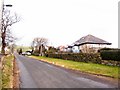
Looking North up West Lane
From the lower western corner of the square, looking up West Lane to the north shows bungalows backing onto Loxley Chase and, further up on the left, Thorn House Barn, which has been converted into a magnificent dwelling.
Image: © Roger May
Taken: 19 Feb 2006
0.15 miles

8
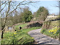
Back Lane, Low Holdworth
A standard Peak National Park millstone sign, with Holdworth House Farm higher up the hillside.
Image: © Alan Murray-Rust
Taken: 27 Mar 2012
0.16 miles
9
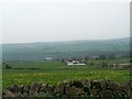
Loxley Valley from Myers Lane, near Worrall, Sheffield
The white House in the middle is Gorse House on West Lane, the building in the far centre of the valley is the Yorkshire Water Treatment Plant in Loxley Bottom. Image
Image: © Terry Robinson
Taken: 10 May 2008
0.16 miles
