
IMAGES TAKEN NEAR TO
Oldfield Road, SHEFFIELD, S6 6EA
Introduction
This page details the photographs taken nearby to Oldfield Road, S6 6EA by members of the Geograph project.
The Geograph project started in 2005 with the aim of publishing, organising and preserving representative images for every square kilometre of Great Britain, Ireland and the Isle of Man.

There are currently over 7.5m images from over14,400 individuals and you can help contribute to the project by visiting https://www.geograph.org.uk
Image Map
Images are licensed for reuse under creativecommons.org/licenses/by-sa/2.0
Notes
- Clicking on the map will re-center to the selected point.
- The higher the marker number, the further away the image location is from the centre of the postcode.
Image Listing (32 Images Found)
Images are licensed for reuse under creativecommons.org/licenses/by-sa/2.0
Image
Details
Distance
1

Bus at Stannington terminus
A bus waits at Nethergate terminus, Stannington, before returning to Sheffield city centre. Buses perform a rather odd manoeuvre to terminate here: approaching from the left, they perform a partial U turn in the mouth of Nethergate before reversing to reach the bus stop.
Image: © Richard Vince
Taken: 24 Apr 2012
0.05 miles
2
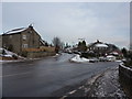
Road junction, Knowle Top, Stannington
Looking along School Lane, from Oldfield Road.
Image: © Peter Barr
Taken: 18 Dec 2010
0.08 miles
4

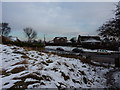
Rivelin valley near Stannington (2)
Looking south west across the Rivelin valley from Nethergate towards the distant hills. The fields on this side of the valley are surprisingly narrow.
Image: © Richard Vince
Taken: 24 Apr 2012
0.11 miles
5

Rivelin valley near Stannington (1)
Looking south from Nethergate across the Rivelin valley. A public footpath can just be discerned on the left. For a similar view in summer, please see Image
Image: © Richard Vince
Taken: 24 Apr 2012
0.13 miles
8
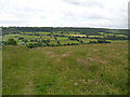
Meadows near Nethergate.
Looking back across the Rivelin valley.
Image: © steven ruffles
Taken: 21 Jun 2011
0.15 miles
9
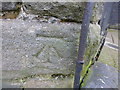
Cut Mark Outbuilding Crown and Glove Pub House
as above
Image: © Monica Stagg
Taken: 25 Feb 2015
0.17 miles
10
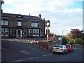
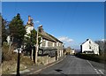
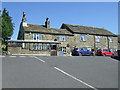
The Crown and Glove Public House
Public house, which according to the July 2012 issue of 'Beer Matters' (the newsletter of the Sheffield Branch of CAMRA) is likely to be only pub in the world with this name. It's situated on Upper Gate in Stannington occupying a prominent position overlooking the north west suburbs of Sheffield.
Image: © Jonathan Clitheroe
Taken: 9 Jun 2011
0.17 miles