
IMAGES TAKEN NEAR TO
Stopes Road, SHEFFIELD, S6 6BW
Introduction
This page details the photographs taken nearby to Stopes Road, S6 6BW by members of the Geograph project.
The Geograph project started in 2005 with the aim of publishing, organising and preserving representative images for every square kilometre of Great Britain, Ireland and the Isle of Man.

There are currently over 7.5m images from over14,400 individuals and you can help contribute to the project by visiting https://www.geograph.org.uk
Image Map
Images are licensed for reuse under creativecommons.org/licenses/by-sa/2.0
Notes
- Clicking on the map will re-center to the selected point.
- The higher the marker number, the further away the image location is from the centre of the postcode.
Image Listing (36 Images Found)
Images are licensed for reuse under creativecommons.org/licenses/by-sa/2.0
Image
Details
Distance
1
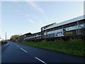
Former factory site alongside B6976 near Stannington
Image: © Steve Fareham
Taken: 29 Dec 2015
0.08 miles
4
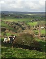
View over The Griffs
To Stopes and Hill Top. The chimney to the right belonged to the now disused Dyson Refractory Works. The Griffs is the country house bottom left.
Image: © Neil Theasby
Taken: 24 Dec 2014
0.14 miles
5
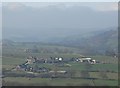
Milky misty view of The Loxley Valley
From Stannington
Image: © Neil Theasby
Taken: 20 Mar 2015
0.15 miles
6
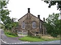
Underbank Day and Sunday School
Erected in 1855 and still looking in good condition.
Image: © Terry Robinson
Taken: 14 Sep 2008
0.15 miles
7
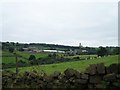
View from Storrs to Stopes
Dyson's Factory, Broad Oak House and Underbank Day and Sunday School can all be seen in this view. Image Image Image
Image: © Terry Robinson
Taken: 14 Sep 2008
0.15 miles
8
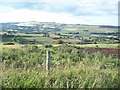
Looking North from Riggs High Road
This picture was taken on an intermittently fine evening in early June. The area in the foreground is Access Land.
Image: © Jonathan Clitheroe
Taken: 9 Jun 2011
0.16 miles
9
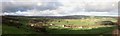
Loxley Valley Panoramic View
From Riggs west of Stannington.
Image: © Neil Theasby
Taken: 24 Dec 2014
0.16 miles
10
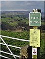
West of Stannington
Start of a public footpath that leads down to The Griffs from Riggs High Road.
Image: © Neil Theasby
Taken: 13 Feb 2020
0.19 miles