IMAGES TAKEN NEAR TO
Morthen Road, ROTHERHAM, S66 9JE
Introduction
This page details the photographs taken nearby to Morthen Road, S66 9JE by members of the Geograph project.
The Geograph project started in 2005 with the aim of publishing, organising and preserving representative images for every square kilometre of Great Britain, Ireland and the Isle of Man.

There are currently over 7.5m images from over14,400 individuals and you can help contribute to the project by visiting https://www.geograph.org.uk
Image Map (Loading...)


Getting Data...Please wait
Leaflet Map data © OpenStreetMap
Images are licensed for reuse under creativecommons.org/licenses/by-sa/2.0
Notes
- Clicking on the map will re-center to the selected point.
- The higher the marker number, the further away the image location is from the centre of the postcode.
Image Listing (6 Images Found)
Images are licensed for reuse under creativecommons.org/licenses/by-sa/2.0
Image
Details
Distance
1
Junction of Morthen Lane and Morthen Hall Lane
Image: © Neil Theasby
Taken: 31 May 2013
0.16 miles
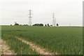
3
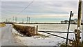
Sheep Dike Lane joins Morthen Hall Lane
Image: © Chris Morgan
Taken: 12 Dec 2017
0.21 miles
4
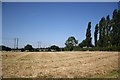
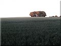
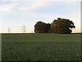
Nether Moor Field
From Green Lane near the junction with Moat Lane
Image: © Richard Croft
Taken: 24 Jul 2006
0.21 miles