
IMAGES TAKEN NEAR TO
Fairbarn Way, SHEFFIELD, S6 5QE
Introduction
This page details the photographs taken nearby to Fairbarn Way, S6 5QE by members of the Geograph project.
The Geograph project started in 2005 with the aim of publishing, organising and preserving representative images for every square kilometre of Great Britain, Ireland and the Isle of Man.

There are currently over 7.5m images from over14,400 individuals and you can help contribute to the project by visiting https://www.geograph.org.uk
Image Map
Images are licensed for reuse under creativecommons.org/licenses/by-sa/2.0
Notes
- Clicking on the map will re-center to the selected point.
- The higher the marker number, the further away the image location is from the centre of the postcode.
Image Listing (39 Images Found)
Images are licensed for reuse under creativecommons.org/licenses/by-sa/2.0
Image
Details
Distance
1
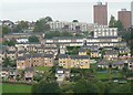
Liberty Hill, Stannington
Semis, bungalows, maisonettes and tower blocks; Stannington, a suburb of Sheffield.
Image: © Peter Barr
Taken: 12 Oct 2010
0.06 miles
2

Fairbarn Drive
Local authority built housing on Fairbarn Drive.
Image: © Martin Speck
Taken: 8 Apr 2009
0.08 miles
4
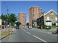
Stannington Road, Sheffield
Looking west on the B6076.
Image: © JThomas
Taken: 30 Jun 2018
0.11 miles
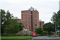
7
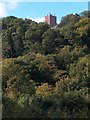
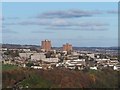
View to Deer Park Flats, Stannington from Rivelin Valley Road
Image: © Neil Theasby
Taken: 6 Oct 2010
0.13 miles
8
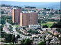
Stannington Road, Sheffield
Stannington has 3 large 15 storey, 41 metre tower blocks, a large area of 1960s council built flats and maisonettes and some private housing. In the early 1900s Stannington was a village. It became a part of Sheffield in 1974. This is a telephoto view of the area known as Deer Park and it was taken from the Bolehills.
Image: © Dave Hitchborne
Taken: 26 Aug 2008
0.14 miles
9
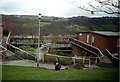
Liberty Hill, Sheffield
Liberty Hill with Rivelin Valley in the background and Sandygate on the top of the hill opposite. Photo taken just outside Hall Park Head community centre.
Liberty Hill was developed by Sheffield City Council in the 1960s and 1970s. The property is a mix of traditional houses, small two-storey flats and the "Swiss-Chalet" type buildings in the near foreground. Due to the slope of the ground both floors have ground level access.
Image: © J G Harston
Taken: Unknown
0.14 miles
