
IMAGES TAKEN NEAR TO
Liberty Close, SHEFFIELD, S6 5PZ
Introduction
This page details the photographs taken nearby to Liberty Close, S6 5PZ by members of the Geograph project.
The Geograph project started in 2005 with the aim of publishing, organising and preserving representative images for every square kilometre of Great Britain, Ireland and the Isle of Man.

There are currently over 7.5m images from over14,400 individuals and you can help contribute to the project by visiting https://www.geograph.org.uk
Image Map
Images are licensed for reuse under creativecommons.org/licenses/by-sa/2.0
Notes
- Clicking on the map will re-center to the selected point.
- The higher the marker number, the further away the image location is from the centre of the postcode.
Image Listing (41 Images Found)
Images are licensed for reuse under creativecommons.org/licenses/by-sa/2.0
Image
Details
Distance
1

Roscoe Bank, Stannington
Centre of frame is where Liberty Drive meets Liberty Hill. When I was on the buses between 1963 and 1973, the route 88 Fulwood to Roscoe Bank ran here from Deer Park Road, across Stannington Road and down Liberty Hill. The passengers would alight and then the bus was reversed into Liberty Drive and then driven left back out onto Liberty Hill and parked in the first lay-by up the hill. I think we had about 20 mins to get to the City centre, outside what was Walshes and then another 22 mins up to Fulwood, via Hunter's Bar and Nether Green.
Image: © Dave Hitchborne
Taken: 26 Aug 2008
0.07 miles
2
Liberty Hill, Stannington
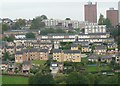
Semis, bungalows, maisonettes and tower blocks; Stannington, a suburb of Sheffield.
Image: © Peter Barr
Taken: 12 Oct 2010
0.07 miles
3

Rivelin Valley Trail, Rivelin Valley, Sheffield
Footbridge across a stream en-route between Rivelin Valley Road and Roscoe stepping stones. This stream joins the River Rivelin a few metres to the left.
Image: © David Hallam-Jones
Taken: 18 Feb 2018
0.09 miles
4
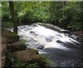
Weir on the River Rivelin
The weir is below the sluice that fed the mill dam for the Holme Head Wheel, one of 20 that were active in a 3-mile stretch of the river
Image: © Graham Hogg
Taken: 10 Sep 2020
0.10 miles
5
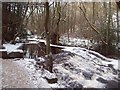
Partly Frozen Weir on the River Rivelin
One of many weirs associated with former mills situated along the course of the river. This one has started to freeze following the prolongued cold snap of December 2010.
Image: © Jonathan Clitheroe
Taken: 23 Dec 2010
0.13 miles
6
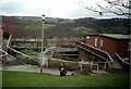
Liberty Hill, Sheffield
Liberty Hill with Rivelin Valley in the background and Sandygate on the top of the hill opposite. Photo taken just outside Hall Park Head community centre.
Liberty Hill was developed by Sheffield City Council in the 1960s and 1970s. The property is a mix of traditional houses, small two-storey flats and the "Swiss-Chalet" type buildings in the near foreground. Due to the slope of the ground both floors have ground level access.
Image: © J G Harston
Taken: Unknown
0.13 miles
7
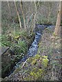
Rivelin Valley Trail, Rivelin Valley, Sheffield
Water from the Nether Cut Wheel mill-pond outlet rejoining the River Rivelin. The Nether Cut mill pond, water wheel and workshops (a.k.a. the New Wheel, Marshall’s Wheel and Kay Wheel) were constructed c.1719 but were then completely rebuilt 60 years later. This small scale industrial unit was used for cutlery-making and scythe grinding until c.1939, it being the last mill in the valley to be worked by a water wheel. The mill was demolished c. 1956 and although all traces of it have now disappeared the mill pond behind the photographer has been preserved for fishing.
Image: © David Hallam-Jones
Taken: 18 Feb 2018
0.14 miles
8
Sycamore Reflection
In The River Rivelin at Rivelin Glen.
Image: © Neil Theasby
Taken: 3 Jul 2015
0.14 miles
9
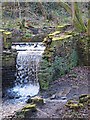
Rivelin Valley Trail, Rivelin Valley, Sheffield
The River Rivelin running into the site previously occupied by the Nether Cut Wheel (a.k.a. the New Wheel, Marshall’s Wheel and Kay Wheel) was constructed c.1719 but it was completely rebuilt 60 years later. It was used for cutlery and scythe grinding until c. 1939, it being the last mill in the valley to be worked by a water wheel. The mill was demolished c. 1956 and although all traces of it have now disappeared the large mill dam, behind the photographer, has been preserved for fishing.
Image: © David Hallam-Jones
Taken: 18 Feb 2018
0.14 miles
10
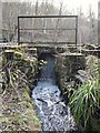
Rivelin Valley Trail, Rivelin Valley, Sheffield
The Nether Cut Wheel mill-pond outlet. The River Rivelin was dammed here to allow for the creation of the Nether Cut water wheel and workshops (a.k.a. the New Wheel, Marshall’s Wheel and Kay Wheel). This small scale industrial complex was constructed c.1719 but then completely rebuilt 60 years later. It was used for cutlery and scythe grinding until c. 1939, it being the last mill in the valley to be worked by a water wheel. The mill was demolished c. 1956 and although all traces of it have now disappeared the mill pond has been preserved for fishing.
Image: © David Hallam-Jones
Taken: 18 Feb 2018
0.14 miles