
IMAGES TAKEN NEAR TO
Goodison Crescent, SHEFFIELD, S6 5HU
Introduction
This page details the photographs taken nearby to Goodison Crescent, S6 5HU by members of the Geograph project.
The Geograph project started in 2005 with the aim of publishing, organising and preserving representative images for every square kilometre of Great Britain, Ireland and the Isle of Man.

There are currently over 7.5m images from over14,400 individuals and you can help contribute to the project by visiting https://www.geograph.org.uk
Image Map
Images are licensed for reuse under creativecommons.org/licenses/by-sa/2.0
Notes
- Clicking on the map will re-center to the selected point.
- The higher the marker number, the further away the image location is from the centre of the postcode.
Image Listing (38 Images Found)
Images are licensed for reuse under creativecommons.org/licenses/by-sa/2.0
Image
Details
Distance
1
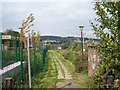
Footpath to Shooters Grove, Wood Lane, Stannington, Sheffield
This footpath, next to the Children's Centre, leads to the original Shooters Grove buildings ... it is these buildings - which can be seen in the distance -which gave the surrounding area its name. Image Image
Image: © Terry Robinson
Taken: 25 Sep 2008
0.05 miles
2
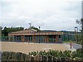
Shooters Grove Children's Centre, Wood Lane, Stannington, Sheffield
Next to this fine, new Children's Centre ... on the left is the Primary School ... and on the right is the footpath to the former Shooters Grove buildings. Image Image Image
Image: © Terry Robinson
Taken: 14 Sep 2008
0.07 miles
3
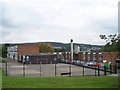
Shooters Grove Primary School. Wood Lane, Stannington, Sheffield - 2
Image: © Terry Robinson
Taken: 25 Sep 2008
0.07 miles
4
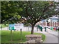
Shooters Grove Primary School, Wood Lane, Stannington, Sheffield - 1
Shooters Grove is a group of buildings (perhaps a farm or shooting lodge), off Wood lane, Stannington, which are shown on the 1902 OS Map of the district. The area surrounding them has become known by this name ... including the Primary School shown in this picture ... Image Next door is a new Children's Centre ... Image ... and the footpath leading to the original buildings is next to that ... Image Image
Image: © Terry Robinson
Taken: 25 Sep 2008
0.08 miles
5
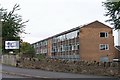
Sheffield College, Loxley Centre, Wood Lane, Sheffield - 2
Image: © Terry Robinson
Taken: 14 Sep 2008
0.11 miles
6
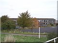
Sheffield College, Loxley Centre, Wood Lane, Sheffield - 3
Image: © Terry Robinson
Taken: 29 Oct 2008
0.11 miles
7
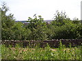
Myers Grove from Shooters Grove.
Looking towards the derelict Loxley College buildings, formerly occupied by Myers Grove School. Trees now obscure the view. Submitted to the BBC Domesday Reloaded project. Image For another BBC Domesday Reloaded project image see Image
Image: © Martin Speck
Taken: 14 Jun 2011
0.12 miles
8
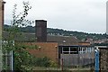
Sheffield College, Loxley Centre, Wood Lane, Sheffield - 4
Image: © Terry Robinson
Taken: 14 Sep 2008
0.12 miles
9
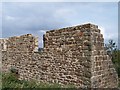
Former Shooters Grove Building, off Wood Lane, Stannington, Sheffield
Image: © Terry Robinson
Taken: 25 Sep 2008
0.12 miles
10

Sheffield College, Loxley Centre, Wood Lane, Sheffield - 1
This building was originally the Sixth Form for the (next door) Myers Grove Secondary School. Loxley College was latterly merged, along with other Further Education Colleges, into the Sheffield College ... hence the signage ... but it will always be known locally as Loxley College.
Image
Image
Image
Image
... for the second part of the college see
Image
Update in August 2021
J G Harston … former pupil (1980 - 1987) and School Governor (2000 - 2010) has contacted me with the following correction to my original text.
“This was originally the lower school buildings, not the sixth form. Year 1 and Year 2, with year 3,4,5 and sixth form in the Upper School buildings.
There may be confusion because when Myers Grove School lost the sixth form they also lost the lower school buildings, which were transfered to Loxley College.”
Image: © Terry Robinson
Taken: 14 Sep 2008
0.13 miles