
IMAGES TAKEN NEAR TO
Tinker Lane, SHEFFIELD, S6 5EA
Introduction
This page details the photographs taken nearby to Tinker Lane, S6 5EA by members of the Geograph project.
The Geograph project started in 2005 with the aim of publishing, organising and preserving representative images for every square kilometre of Great Britain, Ireland and the Isle of Man.

There are currently over 7.5m images from over14,400 individuals and you can help contribute to the project by visiting https://www.geograph.org.uk
Image Map
Images are licensed for reuse under creativecommons.org/licenses/by-sa/2.0
Notes
- Clicking on the map will re-center to the selected point.
- The higher the marker number, the further away the image location is from the centre of the postcode.
Image Listing (69 Images Found)
Images are licensed for reuse under creativecommons.org/licenses/by-sa/2.0
Image
Details
Distance
1

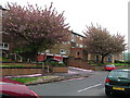
Bottom of Tinker Lane, Walkley
The bottom of Tinker Lane, Walkley, near to where it meets Bole Hill Road. The 95 bus route, which arrives from Sheffield city centre via Bole Hill Road, terminates here (see also Image). Due to the sloping topography of the area, no turning circle is provided. Instead, buses approach past the flats and continue to where the photographer is standing (this is a dead end; only the right hand half of the road continues), then reverse to where the bus in this picture is standing to serve the bus stop before turning hard right to return from whence they came.
Image: © Richard Vince
Taken: 24 Apr 2012
0.01 miles
3

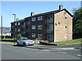
Bus at Tinker Lane terminus, Walkley
A bus waits in the small turning area off Tinker Lane, Walkley, before returning to Sheffield city centre.
Image: © Richard Vince
Taken: 24 Apr 2012
0.02 miles
6
The Bolehills, near Crookes
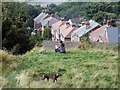
The child is on another shot. She came onto this recreational park and let her dog have a good run around, as others were. The Bolehills are very popular with locals young and old. It was a favourite place of mine, as a child.
Waller Road, the road below, leads down from Bole Hill Road to Rivelin Road and then just a few metres down onto Rivelin Valley Road. At one time my Mother-in-law lived in the very lower end terraced house. It was later demolished due to subsidence. Although we were unaware at the time, she lived not far away from the grave of her mother-in-law, in the nearby cemetery.
Image: © Dave Hitchborne
Taken: 26 Aug 2008
0.06 miles
7
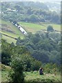
The Bolehills, near Crookes
The views from the Bolehills are spectacular. This view shows the southside of the Rivelin Valley and includes Back Lane, which leads to Crosspool. The white van is at Image and is about to reach the junction of Long Lane, which climbs up from Rivelin Valley Road. Beyond Long Lane, Back Lane climbs very steeply past Clough Fields on the left and allotments on the right.
Image: © Dave Hitchborne
Taken: 26 Aug 2008
0.06 miles
8
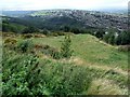
The Bolehills, near Crookes
Many years ago this site was a quarry. The owner, it is said, gave the site for the recreation and relaxation of the residents of Sheffield, or words to that effect.
From this viewpoint, the area has much changed since I ran about here as a child. There is a marked increase in housing and trees. For whatever reason trees were few and far between, even further back in time. I guess they were need for fuel and furniture making and the land was put to use to grow crops.
This c1905 postcard shows the slopes beyond to be treeless and the land to be heavily divided - http://i14.photobucket.com/albums/a303/escafeld01/RivelinValleyfromtheBoleHills1905.jpg
Image: © Dave Hitchborne
Taken: 26 Aug 2008
0.06 miles
10
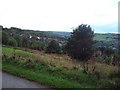
Near Bole Hill Recreation Ground
This picture was taken from a path that runs parallel with Woodfield Road.
Image: © Jonathan Clitheroe
Taken: 23 Sep 2010
0.07 miles